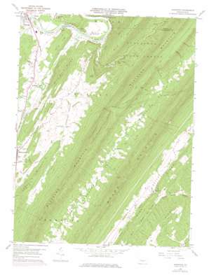
Aughwick Topo Map Pennsylvania
To zoom in, hover over the map of Aughwick
USGS Topo Quad 40077c7 - 1:24,000 scale
| Topo Map Name: | Aughwick |
| USGS Topo Quad ID: | 40077c7 |
| Print Size: | ca. 21 1/4" wide x 27" high |
| Southeast Coordinates: | 40.25° N latitude / 77.75° W longitude |
| Map Center Coordinates: | 40.3125° N latitude / 77.8125° W longitude |
| U.S. State: | PA |
| Filename: | o40077c7.jpg |
| Download Map JPG Image: | Aughwick topo map 1:24,000 scale |
| Map Type: | Topographic |
| Topo Series: | 7.5´ |
| Map Scale: | 1:24,000 |
| Source of Map Images: | United States Geological Survey (USGS) |
| Alternate Map Versions: |
Aughwick PA 1959, updated 1961 Download PDF Buy paper map Aughwick PA 1959, updated 1972 Download PDF Buy paper map Aughwick PA 1959, updated 1976 Download PDF Buy paper map Aughwick PA 2010 Download PDF Buy paper map Aughwick PA 2013 Download PDF Buy paper map Aughwick PA 2016 Download PDF Buy paper map |
1:24,000 Topo Quads surrounding Aughwick
> Back to 40077a1 at 1:100,000 scale
> Back to 40076a1 at 1:250,000 scale
> Back to U.S. Topo Maps home
Aughwick topo map: Gazetteer
Aughwick: Areas
County Line Picnic Area elevation 267m 875′Aughwick: Populated Places
Adams elevation 183m 600′Allenport elevation 177m 580′
Aughwick elevation 171m 561′
Beacon Lodge elevation 180m 590′
Culbertson elevation 250m 820′
Richvale elevation 257m 843′
Shirleysburg elevation 183m 600′
Aughwick: Reservoirs
Mount Union Reservoir elevation 280m 918′Aughwick: Ridges
Big Ridge elevation 390m 1279′Huling Ridge elevation 263m 862′
Lick Ridge elevation 312m 1023′
Mine Bank Ridge elevation 358m 1174′
Pine Ridge elevation 339m 1112′
Pine Ridge elevation 268m 879′
Aughwick: Streams
Aughwick Creek elevation 159m 521′Blocks Run elevation 244m 800′
West Licking Creek elevation 161m 528′
Aughwick: Trails
Anthill Trail elevation 485m 1591′Aughwick: Valleys
Blocks Hollow elevation 245m 803′Germany Valley elevation 192m 629′
Gifford Hollow elevation 280m 918′
Kelley Hollow elevation 287m 941′
Loves Valley elevation 218m 715′
Ross Hollow elevation 278m 912′
Wildcat Hollow elevation 278m 912′
Aughwick digital topo map on disk
Buy this Aughwick topo map showing relief, roads, GPS coordinates and other geographical features, as a high-resolution digital map file on DVD:
Atlantic Coast (NY, NJ, PA, DE, MD, VA, NC)
Buy digital topo maps: Atlantic Coast (NY, NJ, PA, DE, MD, VA, NC)


