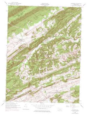
Ickesburg Topo Map Pennsylvania
To zoom in, hover over the map of Ickesburg
USGS Topo Quad 40077d3 - 1:24,000 scale
| Topo Map Name: | Ickesburg |
| USGS Topo Quad ID: | 40077d3 |
| Print Size: | ca. 21 1/4" wide x 27" high |
| Southeast Coordinates: | 40.375° N latitude / 77.25° W longitude |
| Map Center Coordinates: | 40.4375° N latitude / 77.3125° W longitude |
| U.S. State: | PA |
| Filename: | o40077d3.jpg |
| Download Map JPG Image: | Ickesburg topo map 1:24,000 scale |
| Map Type: | Topographic |
| Topo Series: | 7.5´ |
| Map Scale: | 1:24,000 |
| Source of Map Images: | United States Geological Survey (USGS) |
| Alternate Map Versions: |
Ickesburg PA 1952, updated 1958 Download PDF Buy paper map Ickesburg PA 1952, updated 1970 Download PDF Buy paper map Ickesburg PA 1952, updated 1978 Download PDF Buy paper map Ickesburg PA 1952, updated 1978 Download PDF Buy paper map Ickesburg PA 2010 Download PDF Buy paper map Ickesburg PA 2013 Download PDF Buy paper map Ickesburg PA 2016 Download PDF Buy paper map |
1:24,000 Topo Quads surrounding Ickesburg
> Back to 40077a1 at 1:100,000 scale
> Back to 40076a1 at 1:250,000 scale
> Back to U.S. Topo Maps home
Ickesburg topo map: Gazetteer
Ickesburg: Airports
Waller Airport elevation 197m 646′Ickesburg: Areas
Tuscarora Wild Area elevation 611m 2004′Ickesburg: Parks
Green Park elevation 179m 587′Ickesburg: Populated Places
Elliottsburg elevation 195m 639′Erly elevation 194m 636′
Eshcol elevation 173m 567′
Ickesburg elevation 192m 629′
Little Germany elevation 239m 784′
Mannsville elevation 214m 702′
Roseburg elevation 176m 577′
Roseburg elevation 186m 610′
Walnut Grove elevation 168m 551′
Ickesburg: Ridges
Bilman Ridge elevation 338m 1108′Limestone Ridge elevation 303m 994′
Peach Ridge elevation 284m 931′
Sherman Ridge elevation 338m 1108′
Ickesburg: Streams
Panther Creek elevation 175m 574′Ickesburg: Summits
Mahanoy Hill elevation 303m 994′Ickesburg digital topo map on disk
Buy this Ickesburg topo map showing relief, roads, GPS coordinates and other geographical features, as a high-resolution digital map file on DVD:
Atlantic Coast (NY, NJ, PA, DE, MD, VA, NC)
Buy digital topo maps: Atlantic Coast (NY, NJ, PA, DE, MD, VA, NC)


