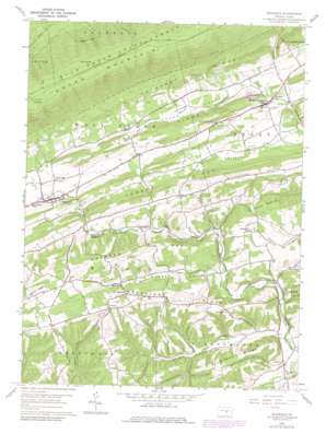
Richfield Topo Map Pennsylvania
To zoom in, hover over the map of Richfield
USGS Topo Quad 40077f1 - 1:24,000 scale
| Topo Map Name: | Richfield |
| USGS Topo Quad ID: | 40077f1 |
| Print Size: | ca. 21 1/4" wide x 27" high |
| Southeast Coordinates: | 40.625° N latitude / 77° W longitude |
| Map Center Coordinates: | 40.6875° N latitude / 77.0625° W longitude |
| U.S. State: | PA |
| Filename: | o40077f1.jpg |
| Download Map JPG Image: | Richfield topo map 1:24,000 scale |
| Map Type: | Topographic |
| Topo Series: | 7.5´ |
| Map Scale: | 1:24,000 |
| Source of Map Images: | United States Geological Survey (USGS) |
| Alternate Map Versions: |
Richfield PA 1959, updated 1961 Download PDF Buy paper map Richfield PA 1959, updated 1970 Download PDF Buy paper map Richfield PA 1959, updated 1979 Download PDF Buy paper map Richfield PA 2010 Download PDF Buy paper map Richfield PA 2013 Download PDF Buy paper map Richfield PA 2016 Download PDF Buy paper map |
1:24,000 Topo Quads surrounding Richfield
> Back to 40077e1 at 1:100,000 scale
> Back to 40076a1 at 1:250,000 scale
> Back to U.S. Topo Maps home
Richfield topo map: Gazetteer
Richfield: Airports
Frymoyer Airport elevation 159m 521′Richfield: Populated Places
Knousetown elevation 230m 754′Mount Pleasant Mill elevation 168m 551′
Mount Pleasant Mills elevation 172m 564′
Oriental elevation 151m 495′
Richfield elevation 200m 656′
Strouptown elevation 259m 849′
Richfield: Post Offices
Mount Pleasant Mills Post Office (historical) elevation 175m 574′Richfield: Ridges
Chestnut Ridge elevation 323m 1059′Dresslers Ridge elevation 249m 816′
Forrey Ridge elevation 293m 961′
Frymoyer Ridge elevation 220m 721′
Graders Ridge elevation 294m 964′
Lime Ridge elevation 318m 1043′
Richfield: Springs
Bear Spring elevation 610m 2001′Richfield: Streams
Leiningers Run elevation 140m 459′Quaker Run elevation 160m 524′
Richfield: Trails
East Boyer Trail elevation 565m 1853′Richfield: Valleys
Hiester Valley elevation 168m 551′Potato Valley elevation 161m 528′
Quaker Valley elevation 166m 544′
Richfield: Woods
The Long Woods elevation 232m 761′Richfield digital topo map on disk
Buy this Richfield topo map showing relief, roads, GPS coordinates and other geographical features, as a high-resolution digital map file on DVD:
Atlantic Coast (NY, NJ, PA, DE, MD, VA, NC)
Buy digital topo maps: Atlantic Coast (NY, NJ, PA, DE, MD, VA, NC)


