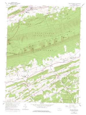
Beaver Springs Topo Map Pennsylvania
To zoom in, hover over the map of Beaver Springs
USGS Topo Quad 40077f2 - 1:24,000 scale
| Topo Map Name: | Beaver Springs |
| USGS Topo Quad ID: | 40077f2 |
| Print Size: | ca. 21 1/4" wide x 27" high |
| Southeast Coordinates: | 40.625° N latitude / 77.125° W longitude |
| Map Center Coordinates: | 40.6875° N latitude / 77.1875° W longitude |
| U.S. State: | PA |
| Filename: | o40077f2.jpg |
| Download Map JPG Image: | Beaver Springs topo map 1:24,000 scale |
| Map Type: | Topographic |
| Topo Series: | 7.5´ |
| Map Scale: | 1:24,000 |
| Source of Map Images: | United States Geological Survey (USGS) |
| Alternate Map Versions: |
Beaver Springs PA 1959, updated 1961 Download PDF Buy paper map Beaver Springs PA 1959, updated 1971 Download PDF Buy paper map Beaver Springs PA 1959, updated 1978 Download PDF Buy paper map Beaver Springs PA 2010 Download PDF Buy paper map Beaver Springs PA 2013 Download PDF Buy paper map Beaver Springs PA 2016 Download PDF Buy paper map |
1:24,000 Topo Quads surrounding Beaver Springs
> Back to 40077e1 at 1:100,000 scale
> Back to 40076a1 at 1:250,000 scale
> Back to U.S. Topo Maps home
Beaver Springs topo map: Gazetteer
Beaver Springs: Airports
Shelley Private Airport elevation 229m 751′Beaver Springs: Basins
Slim Valley elevation 240m 787′Beaver Springs: Dams
Pa-638 Reservoir elevation 210m 688′Beaver Springs: Gaps
Allen Gap elevation 486m 1594′Amey Gap elevation 462m 1515′
Botteiger Gap elevation 489m 1604′
Ferster Gap elevation 489m 1604′
Romig Gap elevation 481m 1578′
Shellenberger Gap elevation 533m 1748′
Varner Gap elevation 442m 1450′
Beaver Springs: Populated Places
Beaver Springs elevation 181m 593′Bunkertown elevation 209m 685′
Cocolamus elevation 199m 652′
Evendale elevation 217m 711′
Gimberlings Mill elevation 189m 620′
Kellerville elevation 212m 695′
Loschs elevation 184m 603′
Stony Run elevation 195m 639′
Swales elevation 203m 666′
Beaver Springs: Reservoirs
Pa-638 Reservoir elevation 210m 688′Beaver Springs: Ridges
Flint Ridge elevation 341m 1118′Ore Ridge elevation 331m 1085′
Beaver Springs: Springs
Bear Spring elevation 608m 1994′Beaver Springs: Streams
Dunn Valley Creek elevation 198m 649′Mitchell Run elevation 182m 597′
Beaver Springs: Valleys
Dunn Valley elevation 199m 652′Leister Valley elevation 197m 646′
Page Valley elevation 190m 623′
Swartz Valley elevation 184m 603′
Beaver Springs digital topo map on disk
Buy this Beaver Springs topo map showing relief, roads, GPS coordinates and other geographical features, as a high-resolution digital map file on DVD:
Atlantic Coast (NY, NJ, PA, DE, MD, VA, NC)
Buy digital topo maps: Atlantic Coast (NY, NJ, PA, DE, MD, VA, NC)


