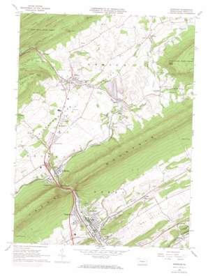
Burnham Topo Map Pennsylvania
To zoom in, hover over the map of Burnham
USGS Topo Quad 40077f5 - 1:24,000 scale
| Topo Map Name: | Burnham |
| USGS Topo Quad ID: | 40077f5 |
| Print Size: | ca. 21 1/4" wide x 27" high |
| Southeast Coordinates: | 40.625° N latitude / 77.5° W longitude |
| Map Center Coordinates: | 40.6875° N latitude / 77.5625° W longitude |
| U.S. State: | PA |
| Filename: | o40077f5.jpg |
| Download Map JPG Image: | Burnham topo map 1:24,000 scale |
| Map Type: | Topographic |
| Topo Series: | 7.5´ |
| Map Scale: | 1:24,000 |
| Source of Map Images: | United States Geological Survey (USGS) |
| Alternate Map Versions: |
Burnham PA 1966, updated 1968 Download PDF Buy paper map Burnham PA 1966, updated 1973 Download PDF Buy paper map Burnham PA 1966, updated 1973 Download PDF Buy paper map Burnham PA 1977, updated 1979 Download PDF Buy paper map Burnham PA 2010 Download PDF Buy paper map Burnham PA 2013 Download PDF Buy paper map Burnham PA 2016 Download PDF Buy paper map |
1:24,000 Topo Quads surrounding Burnham
> Back to 40077e1 at 1:100,000 scale
> Back to 40076a1 at 1:250,000 scale
> Back to U.S. Topo Maps home
Burnham topo map: Gazetteer
Burnham: Flats
Potlicker Flats elevation 259m 849′Burnham: Gaps
Mann Narrows elevation 203m 666′Short Drive Gap elevation 342m 1122′
Will Johns Gap elevation 395m 1295′
Burnham: Populated Places
Burnham elevation 171m 561′Church Hill elevation 239m 784′
Garden View elevation 256m 839′
Honey elevation 214m 702′
Honey Creek elevation 196m 643′
Knobville elevation 219m 718′
Locke Mills elevation 210m 688′
Lumber City elevation 184m 603′
Maitland elevation 166m 544′
Milroy elevation 237m 777′
Mount Pleasant elevation 271m 889′
Naginey elevation 203m 666′
Reedsville elevation 181m 593′
Roseann elevation 259m 849′
Shrader elevation 200m 656′
Siglerville elevation 229m 751′
Vira elevation 181m 593′
Woodland elevation 245m 803′
Yeagertown elevation 177m 580′
Burnham: Springs
Mammoth Spring elevation 206m 675′Burnham: Streams
Buck Run elevation 151m 495′Coffee Run elevation 193m 633′
Havice Creek elevation 212m 695′
Honey Creek elevation 176m 577′
Hungry Run elevation 152m 498′
Laurel Creek elevation 198m 649′
Lingle Creek elevation 244m 800′
Tea Creek elevation 178m 583′
Treaster Run elevation 207m 679′
Burnham: Summits
Beatty Knob elevation 501m 1643′Straley Knob elevation 445m 1459′
Burnham: Trails
Coxes Valley Trail elevation 495m 1624′Kratzer Trail elevation 382m 1253′
Burnham: Valleys
Dry Valley elevation 158m 518′Kishacoquillas Valley elevation 244m 800′
New Lancaster Valley elevation 209m 685′
Treaster Valley elevation 218m 715′
Burnham digital topo map on disk
Buy this Burnham topo map showing relief, roads, GPS coordinates and other geographical features, as a high-resolution digital map file on DVD:
Atlantic Coast (NY, NJ, PA, DE, MD, VA, NC)
Buy digital topo maps: Atlantic Coast (NY, NJ, PA, DE, MD, VA, NC)


