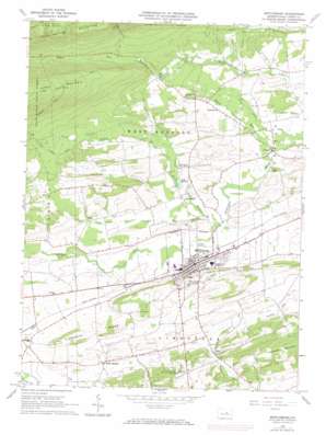
Mifflinburg Topo Map Pennsylvania
To zoom in, hover over the map of Mifflinburg
USGS Topo Quad 40077h1 - 1:24,000 scale
| Topo Map Name: | Mifflinburg |
| USGS Topo Quad ID: | 40077h1 |
| Print Size: | ca. 21 1/4" wide x 27" high |
| Southeast Coordinates: | 40.875° N latitude / 77° W longitude |
| Map Center Coordinates: | 40.9375° N latitude / 77.0625° W longitude |
| U.S. State: | PA |
| Filename: | o40077h1.jpg |
| Download Map JPG Image: | Mifflinburg topo map 1:24,000 scale |
| Map Type: | Topographic |
| Topo Series: | 7.5´ |
| Map Scale: | 1:24,000 |
| Source of Map Images: | United States Geological Survey (USGS) |
| Alternate Map Versions: |
Mifflinburg PA 1965, updated 1966 Download PDF Buy paper map Mifflinburg PA 1965, updated 1973 Download PDF Buy paper map Mifflinburg PA 2010 Download PDF Buy paper map Mifflinburg PA 2013 Download PDF Buy paper map Mifflinburg PA 2016 Download PDF Buy paper map |
1:24,000 Topo Quads surrounding Mifflinburg
> Back to 40077e1 at 1:100,000 scale
> Back to 40076a1 at 1:250,000 scale
> Back to U.S. Topo Maps home
Mifflinburg topo map: Gazetteer
Mifflinburg: Airports
Hoffman Airport elevation 165m 541′Mifflinburg: Bridges
End O'Narrows Bridge elevation 227m 744′Mifflinburg: Lakes
Lake McClure elevation 180m 590′Mifflinburg: Parks
Sand Bridge State Park elevation 479m 1571′State Game Lands Number 201 elevation 189m 620′
Mifflinburg: Populated Places
Cowan elevation 158m 518′Dice elevation 167m 547′
Forest Hill elevation 214m 702′
Johnstown elevation 171m 561′
Mifflinburg elevation 178m 583′
Rand elevation 200m 656′
Red Bank elevation 189m 620′
Tannertown elevation 201m 659′
White Springs elevation 174m 570′
Mifflinburg: Ridges
Limestone Ridge elevation 254m 833′Mifflinburg: Springs
Chambers Spring elevation 178m 583′Mifflinburg: Streams
Coal Run elevation 164m 538′North Branch Buffalo Creek elevation 162m 531′
Rapid Run elevation 155m 508′
Stony Run elevation 153m 501′
Turkey Run elevation 169m 554′
Mifflinburg digital topo map on disk
Buy this Mifflinburg topo map showing relief, roads, GPS coordinates and other geographical features, as a high-resolution digital map file on DVD:
Atlantic Coast (NY, NJ, PA, DE, MD, VA, NC)
Buy digital topo maps: Atlantic Coast (NY, NJ, PA, DE, MD, VA, NC)


