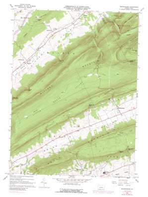
Madisonburg Topo Map Pennsylvania
To zoom in, hover over the map of Madisonburg
USGS Topo Quad 40077h5 - 1:24,000 scale
| Topo Map Name: | Madisonburg |
| USGS Topo Quad ID: | 40077h5 |
| Print Size: | ca. 21 1/4" wide x 27" high |
| Southeast Coordinates: | 40.875° N latitude / 77.5° W longitude |
| Map Center Coordinates: | 40.9375° N latitude / 77.5625° W longitude |
| U.S. State: | PA |
| Filename: | o40077h5.jpg |
| Download Map JPG Image: | Madisonburg topo map 1:24,000 scale |
| Map Type: | Topographic |
| Topo Series: | 7.5´ |
| Map Scale: | 1:24,000 |
| Source of Map Images: | United States Geological Survey (USGS) |
| Alternate Map Versions: |
Madisonburg PA 1966, updated 1968 Download PDF Buy paper map Madisonburg PA 1966, updated 1973 Download PDF Buy paper map Madisonburg PA 1966, updated 1989 Download PDF Buy paper map Madisonburg PA 1966, updated 1989 Download PDF Buy paper map Madisonburg PA 1977, updated 1979 Download PDF Buy paper map Madisonburg PA 2010 Download PDF Buy paper map Madisonburg PA 2013 Download PDF Buy paper map Madisonburg PA 2016 Download PDF Buy paper map |
1:24,000 Topo Quads surrounding Madisonburg
> Back to 40077e1 at 1:100,000 scale
> Back to 40076a1 at 1:250,000 scale
> Back to U.S. Topo Maps home
Madisonburg topo map: Gazetteer
Madisonburg: Airports
Penns Cave Airport elevation 383m 1256′Madisonburg: Gaps
Bressler Gap elevation 482m 1581′Fulton Gap elevation 418m 1371′
Gingerich Gap elevation 464m 1522′
Lees Gap elevation 358m 1174′
Markle Gap elevation 431m 1414′
Smithtown Gap elevation 451m 1479′
Madisonburg: Populated Places
Green Grove elevation 368m 1207′Hublersburg elevation 286m 938′
Madisonburg elevation 394m 1292′
Nittany elevation 272m 892′
Snydertown elevation 269m 882′
Madisonburg: Springs
Penns Cave Spring elevation 361m 1184′Madisonburg: Streams
Bear Hollow Run elevation 339m 1112′Laurel Run elevation 375m 1230′
Spring Run elevation 259m 849′
Madisonburg: Summits
Big Kettle Mountain elevation 688m 2257′Big Mountain elevation 568m 1863′
Hickory Knob elevation 397m 1302′
Madisonburg: Valleys
Brush Valley elevation 351m 1151′Krise Valley elevation 287m 941′
Little Sugar Valley elevation 377m 1236′
Madisonburg digital topo map on disk
Buy this Madisonburg topo map showing relief, roads, GPS coordinates and other geographical features, as a high-resolution digital map file on DVD:
Atlantic Coast (NY, NJ, PA, DE, MD, VA, NC)
Buy digital topo maps: Atlantic Coast (NY, NJ, PA, DE, MD, VA, NC)


