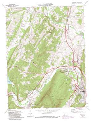
Bedford Topo Map Pennsylvania
To zoom in, hover over the map of Bedford
USGS Topo Quad 40078a5 - 1:24,000 scale
| Topo Map Name: | Bedford |
| USGS Topo Quad ID: | 40078a5 |
| Print Size: | ca. 21 1/4" wide x 27" high |
| Southeast Coordinates: | 40° N latitude / 78.5° W longitude |
| Map Center Coordinates: | 40.0625° N latitude / 78.5625° W longitude |
| U.S. State: | PA |
| Filename: | o40078a5.jpg |
| Download Map JPG Image: | Bedford topo map 1:24,000 scale |
| Map Type: | Topographic |
| Topo Series: | 7.5´ |
| Map Scale: | 1:24,000 |
| Source of Map Images: | United States Geological Survey (USGS) |
| Alternate Map Versions: |
Bedford PA 1971, updated 1973 Download PDF Buy paper map Bedford PA 1971, updated 1982 Download PDF Buy paper map Bedford PA 1971, updated 1987 Download PDF Buy paper map Bedford PA 2010 Download PDF Buy paper map Bedford PA 2013 Download PDF Buy paper map Bedford PA 2016 Download PDF Buy paper map |
1:24,000 Topo Quads surrounding Bedford
> Back to 40078a1 at 1:100,000 scale
> Back to 40078a1 at 1:250,000 scale
> Back to U.S. Topo Maps home
Bedford topo map: Gazetteer
Bedford: Airports
Bedford Airport elevation 361m 1184′Bedford: Basins
Quaker Valley elevation 354m 1161′Bedford: Bridges
Claycomb Covered Bridge elevation 330m 1082′Herline Covered Bridge elevation 353m 1158′
Bedford: Dams
John C Smith Dam elevation 423m 1387′Milburn Spring Dam elevation 408m 1338′
Shawnee Dam elevation 357m 1171′
Todd Spring Dam elevation 379m 1243′
Bedford: Populated Places
Bedford elevation 341m 1118′Belden elevation 335m 1099′
Cessna elevation 339m 1112′
Fishertown elevation 358m 1174′
Manns Choice elevation 365m 1197′
Napier elevation 339m 1112′
Point elevation 382m 1253′
Springhope elevation 371m 1217′
Wolfsburg elevation 334m 1095′
Bedford: Post Offices
Bedford Springs Post Office (historical) elevation 341m 1118′Bedford: Reservoirs
John C Smith Reservoir elevation 423m 1387′Milburn Spring Reservoir elevation 408m 1338′
Shawnee Lake elevation 358m 1174′
Smith Reservoir elevation 407m 1335′
Todd Spring Reservoir elevation 379m 1243′
Bedford: Streams
Adams Run elevation 333m 1092′Brush Run elevation 333m 1092′
Buffalo Run elevation 344m 1128′
Cumberland Valley Run elevation 314m 1030′
Oppenheimer Run elevation 337m 1105′
Shawnee Branch elevation 348m 1141′
Bedford: Summits
Kinton Knob elevation 779m 2555′Pigeon Hills elevation 557m 1827′
Bedford: Valleys
Sloan Hollow elevation 336m 1102′Bedford digital topo map on disk
Buy this Bedford topo map showing relief, roads, GPS coordinates and other geographical features, as a high-resolution digital map file on DVD:


