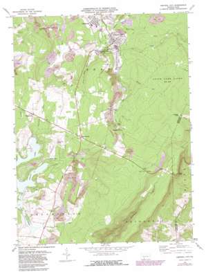
Central City Topo Map Pennsylvania
To zoom in, hover over the map of Central City
USGS Topo Quad 40078a7 - 1:24,000 scale
| Topo Map Name: | Central City |
| USGS Topo Quad ID: | 40078a7 |
| Print Size: | ca. 21 1/4" wide x 27" high |
| Southeast Coordinates: | 40° N latitude / 78.75° W longitude |
| Map Center Coordinates: | 40.0625° N latitude / 78.8125° W longitude |
| U.S. State: | PA |
| Filename: | o40078a7.jpg |
| Download Map JPG Image: | Central City topo map 1:24,000 scale |
| Map Type: | Topographic |
| Topo Series: | 7.5´ |
| Map Scale: | 1:24,000 |
| Source of Map Images: | United States Geological Survey (USGS) |
| Alternate Map Versions: |
Central City PA 1971, updated 1972 Download PDF Buy paper map Central City PA 1971, updated 1982 Download PDF Buy paper map Central City PA 1977, updated 1979 Download PDF Buy paper map Central City PA 2010 Download PDF Buy paper map Central City PA 2013 Download PDF Buy paper map Central City PA 2016 Download PDF Buy paper map |
1:24,000 Topo Quads surrounding Central City
> Back to 40078a1 at 1:100,000 scale
> Back to 40078a1 at 1:250,000 scale
> Back to U.S. Topo Maps home
Central City topo map: Gazetteer
Central City: Airports
Indian Lake Airpark (historical) elevation 742m 2434′Central City: Dams
Indian Lake Dam elevation 691m 2267′Central City: Parks
State Game Lands Number 228 elevation 823m 2700′Central City: Populated Places
Boone elevation 689m 2260′Buckstown elevation 731m 2398′
Cairnbrook elevation 678m 2224′
Central City elevation 670m 2198′
Gahagen elevation 773m 2536′
Grand View elevation 735m 2411′
Indian Lake elevation 717m 2352′
Reels Corners elevation 775m 2542′
Central City: Reservoirs
Indian Lake elevation 678m 2224′Central City: Streams
Beaverdam Run elevation 670m 2198′Boone Run elevation 682m 2237′
Calendars Run elevation 716m 2349′
Clear Run elevation 694m 2276′
Coal Run elevation 686m 2250′
Laurel Run elevation 657m 2155′
Little Dark Shade Creek elevation 660m 2165′
Panther Run elevation 669m 2194′
Shingle Run elevation 686m 2250′
Central City: Summits
Central City Vista elevation 798m 2618′Central City digital topo map on disk
Buy this Central City topo map showing relief, roads, GPS coordinates and other geographical features, as a high-resolution digital map file on DVD:


