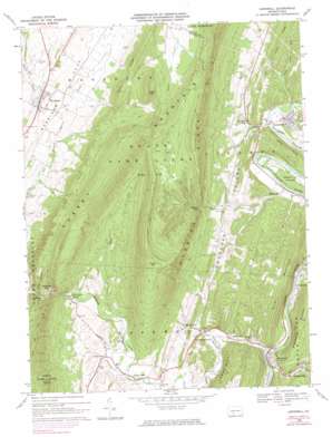
Hopewell Topo Map Pennsylvania
To zoom in, hover over the map of Hopewell
USGS Topo Quad 40078b3 - 1:24,000 scale
| Topo Map Name: | Hopewell |
| USGS Topo Quad ID: | 40078b3 |
| Print Size: | ca. 21 1/4" wide x 27" high |
| Southeast Coordinates: | 40.125° N latitude / 78.25° W longitude |
| Map Center Coordinates: | 40.1875° N latitude / 78.3125° W longitude |
| U.S. State: | PA |
| Filename: | o40078b3.jpg |
| Download Map JPG Image: | Hopewell topo map 1:24,000 scale |
| Map Type: | Topographic |
| Topo Series: | 7.5´ |
| Map Scale: | 1:24,000 |
| Source of Map Images: | United States Geological Survey (USGS) |
| Alternate Map Versions: |
Hopewell PA 1968, updated 1970 Download PDF Buy paper map Hopewell PA 1968, updated 1974 Download PDF Buy paper map Hopewell PA 1968, updated 1984 Download PDF Buy paper map Hopewell PA 1994, updated 1997 Download PDF Buy paper map Hopewell PA 2010 Download PDF Buy paper map Hopewell PA 2013 Download PDF Buy paper map Hopewell PA 2016 Download PDF Buy paper map |
1:24,000 Topo Quads surrounding Hopewell
> Back to 40078a1 at 1:100,000 scale
> Back to 40078a1 at 1:250,000 scale
> Back to U.S. Topo Maps home
Hopewell topo map: Gazetteer
Hopewell: Gaps
Ravers Gap elevation 382m 1253′Hopewell: Parks
Warriors Path State Park elevation 269m 882′Hopewell: Populated Places
Cottles Corner elevation 294m 964′Eichelbergertown elevation 270m 885′
Homans Corner elevation 268m 879′
Hopewell elevation 273m 895′
Langdondale elevation 319m 1046′
Little Jack Corners elevation 324m 1062′
Loysburg Gap elevation 341m 1118′
Marble City elevation 295m 967′
Marysville elevation 257m 843′
Riddlesburg elevation 263m 862′
Stonerstown elevation 255m 836′
Sunny Side elevation 266m 872′
Woodbury elevation 390m 1279′
Yellow Creek elevation 288m 944′
Hopewell: Post Offices
Yellow Creek Post Office (historical) elevation 288m 944′Hopewell: Ranges
Tussey Mountain elevation 737m 2417′Hopewell: Ridges
Abbot Ridge elevation 322m 1056′Byers Ridge elevation 537m 1761′
Piney Ridge elevation 336m 1102′
Hopewell: Streams
Bank Run elevation 268m 879′Bear Run elevation 516m 1692′
Beaver Creek elevation 339m 1112′
Dry Run elevation 244m 800′
Longs Run elevation 305m 1000′
Maple Run elevation 300m 984′
Ravers Run elevation 250m 820′
Sandy Run elevation 263m 862′
Sixmile Run elevation 258m 846′
Sugar Camp Run elevation 238m 780′
Yellow Creek elevation 261m 856′
Hopewell: Summits
Coot Hill elevation 757m 2483′Pulpit Hill elevation 707m 2319′
Riddlesburg Mountain elevation 499m 1637′
River Mountain elevation 438m 1437′
Hopewell: Valleys
Dark Hollow elevation 343m 1125′Morrison Cove elevation 439m 1440′
Woodcock Valley elevation 275m 902′
Hopewell digital topo map on disk
Buy this Hopewell topo map showing relief, roads, GPS coordinates and other geographical features, as a high-resolution digital map file on DVD:


