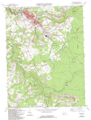
Windber Topo Map Pennsylvania
To zoom in, hover over the map of Windber
USGS Topo Quad 40078b7 - 1:24,000 scale
| Topo Map Name: | Windber |
| USGS Topo Quad ID: | 40078b7 |
| Print Size: | ca. 21 1/4" wide x 27" high |
| Southeast Coordinates: | 40.125° N latitude / 78.75° W longitude |
| Map Center Coordinates: | 40.1875° N latitude / 78.8125° W longitude |
| U.S. State: | PA |
| Filename: | o40078b7.jpg |
| Download Map JPG Image: | Windber topo map 1:24,000 scale |
| Map Type: | Topographic |
| Topo Series: | 7.5´ |
| Map Scale: | 1:24,000 |
| Source of Map Images: | United States Geological Survey (USGS) |
| Alternate Map Versions: |
Windber PA 1971, updated 1973 Download PDF Buy paper map Windber PA 1971, updated 1982 Download PDF Buy paper map Windber PA 1971, updated 1989 Download PDF Buy paper map Windber PA 1971, updated 1994 Download PDF Buy paper map Windber PA 1977, updated 1979 Download PDF Buy paper map Windber PA 1998, updated 1999 Download PDF Buy paper map Windber PA 2010 Download PDF Buy paper map Windber PA 2013 Download PDF Buy paper map Windber PA 2016 Download PDF Buy paper map |
1:24,000 Topo Quads surrounding Windber
> Back to 40078a1 at 1:100,000 scale
> Back to 40078a1 at 1:250,000 scale
> Back to U.S. Topo Maps home
Windber topo map: Gazetteer
Windber: Areas
Babcock Picnic Area elevation 695m 2280′Clear Shade Wild Area elevation 744m 2440′
Windber: Dams
Bigan Dam elevation 627m 2057′Kyle Dam elevation 644m 2112′
Windber: Mines
Mine Number 36 elevation 542m 1778′Mine Number 42 elevation 607m 1991′
Windber: Pillars
Wolf Rock elevation 756m 2480′Windber: Populated Places
Ashtola elevation 676m 2217′Forward elevation 771m 2529′
Hagero elevation 651m 2135′
Hillsboro elevation 543m 1781′
Old Shade Furnace elevation 622m 2040′
Paint elevation 506m 1660′
Reitz elevation 668m 2191′
Rummel elevation 569m 1866′
Scalp Level elevation 537m 1761′
Windber elevation 538m 1765′
Windber: Post Offices
Shade Furnace Post Office (historical) elevation 622m 2040′Windber: Reservoirs
Bigan Pond elevation 627m 2057′Windber Reservoir elevation 677m 2221′
Windber: Streams
Babcock Creek elevation 581m 1906′Clear Shade Creek elevation 621m 2037′
Dark Shade Creek elevation 622m 2040′
Hinson Run elevation 566m 1856′
Little Paint Creek elevation 491m 1610′
Miller Run elevation 630m 2066′
Piney Run elevation 668m 2191′
Roaring Fork elevation 542m 1778′
Sandy Run elevation 616m 2020′
Seese Run elevation 512m 1679′
Spruce Run elevation 493m 1617′
Weaver Run elevation 517m 1696′
Windber: Summits
Brier Knob elevation 771m 2529′Windber: Trails
John P Saylor Trail elevation 741m 2431′Lost Turkey Trail elevation 730m 2395′
Old '56' Trail elevation 739m 2424′
Wolf Rocks Trail elevation 748m 2454′
Windber digital topo map on disk
Buy this Windber topo map showing relief, roads, GPS coordinates and other geographical features, as a high-resolution digital map file on DVD:


