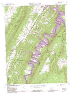
Entriken Topo Map Pennsylvania
To zoom in, hover over the map of Entriken
USGS Topo Quad 40078c2 - 1:24,000 scale
| Topo Map Name: | Entriken |
| USGS Topo Quad ID: | 40078c2 |
| Print Size: | ca. 21 1/4" wide x 27" high |
| Southeast Coordinates: | 40.25° N latitude / 78.125° W longitude |
| Map Center Coordinates: | 40.3125° N latitude / 78.1875° W longitude |
| U.S. State: | PA |
| Filename: | o40078c2.jpg |
| Download Map JPG Image: | Entriken topo map 1:24,000 scale |
| Map Type: | Topographic |
| Topo Series: | 7.5´ |
| Map Scale: | 1:24,000 |
| Source of Map Images: | United States Geological Survey (USGS) |
| Alternate Map Versions: |
Entriken PA 1963, updated 1964 Download PDF Buy paper map Entriken PA 1963, updated 1973 Download PDF Buy paper map Entriken PA 1963, updated 1982 Download PDF Buy paper map Entriken PA 1963, updated 1990 Download PDF Buy paper map Entriken PA 1963, updated 1990 Download PDF Buy paper map Entriken PA 2010 Download PDF Buy paper map Entriken PA 2013 Download PDF Buy paper map Entriken PA 2016 Download PDF Buy paper map |
1:24,000 Topo Quads surrounding Entriken
> Back to 40078a1 at 1:100,000 scale
> Back to 40078a1 at 1:250,000 scale
> Back to U.S. Topo Maps home
Entriken topo map: Gazetteer
Entriken: Airports
Fouses Airport elevation 268m 879′Entriken: Areas
James Creek Access Area elevation 245m 803′Shy Beaver Access Area elevation 247m 810′
Tarman Run Access Area elevation 243m 797′
Tatman Run Access Area elevation 241m 790′
Trough Creek Wild Area elevation 476m 1561′
Entriken: Islands
Pee Wee Island elevation 239m 784′Entriken: Parks
Trough Creek State Park elevation 327m 1072′Entriken: Populated Places
Aitch elevation 239m 784′Beavertown elevation 359m 1177′
Cherrytown elevation 291m 954′
Entriken elevation 276m 905′
Foxton elevation 332m 1089′
Newburg elevation 355m 1164′
Paradise Furnace elevation 299m 980′
Russellville elevation 292m 958′
Salter elevation 424m 1391′
Trough Creek elevation 367m 1204′
Entriken: Ridges
Allegrippis Ridge elevation 380m 1246′Backbone Ridge elevation 289m 948′
Piney Ridge elevation 344m 1128′
Entriken: Streams
Coffee Run elevation 239m 784′Great Trough Creek elevation 239m 784′
James Creek elevation 239m 784′
Shy Beaver Creek elevation 239m 784′
Tatman Run elevation 239m 784′
Entriken: Summits
Balanced Rock elevation 265m 869′Bunns Mountain elevation 575m 1886′
Round Mountain elevation 581m 1906′
Entriken: Valleys
Little Valley elevation 280m 918′Little Valley elevation 364m 1194′
Entriken digital topo map on disk
Buy this Entriken topo map showing relief, roads, GPS coordinates and other geographical features, as a high-resolution digital map file on DVD:


