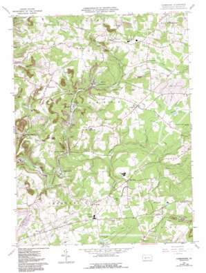
Commodore Topo Map Pennsylvania
To zoom in, hover over the map of Commodore
USGS Topo Quad 40078f8 - 1:24,000 scale
| Topo Map Name: | Commodore |
| USGS Topo Quad ID: | 40078f8 |
| Print Size: | ca. 21 1/4" wide x 27" high |
| Southeast Coordinates: | 40.625° N latitude / 78.875° W longitude |
| Map Center Coordinates: | 40.6875° N latitude / 78.9375° W longitude |
| U.S. State: | PA |
| Filename: | o40078f8.jpg |
| Download Map JPG Image: | Commodore topo map 1:24,000 scale |
| Map Type: | Topographic |
| Topo Series: | 7.5´ |
| Map Scale: | 1:24,000 |
| Source of Map Images: | United States Geological Survey (USGS) |
| Alternate Map Versions: |
Commodore PA 1961, updated 1963 Download PDF Buy paper map Commodore PA 1961, updated 1973 Download PDF Buy paper map Commodore PA 1961, updated 1982 Download PDF Buy paper map Commodore PA 1961, updated 1993 Download PDF Buy paper map Commodore PA 1961, updated 1993 Download PDF Buy paper map Commodore PA 2010 Download PDF Buy paper map Commodore PA 2013 Download PDF Buy paper map Commodore PA 2016 Download PDF Buy paper map |
1:24,000 Topo Quads surrounding Commodore
> Back to 40078e1 at 1:100,000 scale
> Back to 40078a1 at 1:250,000 scale
> Back to U.S. Topo Maps home
Commodore topo map: Gazetteer
Commodore: Dams
Davis Dam elevation 450m 1476′Commodore: Lakes
Laurel Run Lake elevation 465m 1525′Commodore: Populated Places
Bencetown elevation 409m 1341′Buck Run elevation 420m 1377′
Commodore elevation 433m 1420′
Cookport elevation 491m 1610′
Diamondville elevation 403m 1322′
Fleming Summit elevation 479m 1571′
Grisemore elevation 539m 1768′
Jewtown elevation 541m 1774′
Kenwood elevation 481m 1578′
Learn Settlement elevation 477m 1564′
Lovejoy elevation 424m 1391′
Manor elevation 462m 1515′
Mentcle elevation 539m 1768′
Pine Flats elevation 470m 1541′
Purchase Line elevation 507m 1663′
Seamentown elevation 439m 1440′
Starford elevation 412m 1351′
Taylorsville elevation 486m 1594′
Wandin Junction elevation 415m 1361′
Commodore: Post Offices
Standford Post Office (historical) elevation 425m 1394′Commodore: Streams
Bakers Run elevation 467m 1532′Browns Run elevation 388m 1272′
North Branch Two Lick Creek elevation 393m 1289′
Pompey Run elevation 408m 1338′
Repine Run elevation 431m 1414′
Rock Run elevation 416m 1364′
Sides Run elevation 424m 1391′
South Branch Cush Creek elevation 507m 1663′
South Branch Two Lick Creek elevation 393m 1289′
Whitaker Run elevation 402m 1318′
Commodore: Summits
Buck Hill elevation 517m 1696′Turkey Knob elevation 514m 1686′
Commodore digital topo map on disk
Buy this Commodore topo map showing relief, roads, GPS coordinates and other geographical features, as a high-resolution digital map file on DVD:


