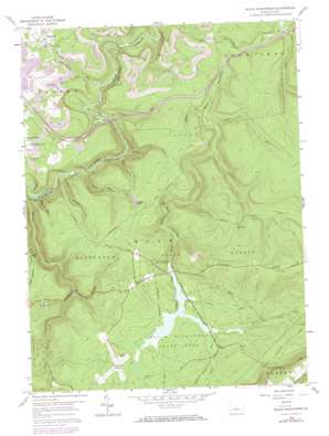
Black Moshannon Topo Map Pennsylvania
To zoom in, hover over the map of Black Moshannon
USGS Topo Quad 40078h1 - 1:24,000 scale
| Topo Map Name: | Black Moshannon |
| USGS Topo Quad ID: | 40078h1 |
| Print Size: | ca. 21 1/4" wide x 27" high |
| Southeast Coordinates: | 40.875° N latitude / 78° W longitude |
| Map Center Coordinates: | 40.9375° N latitude / 78.0625° W longitude |
| U.S. State: | PA |
| Filename: | o40078h1.jpg |
| Download Map JPG Image: | Black Moshannon topo map 1:24,000 scale |
| Map Type: | Topographic |
| Topo Series: | 7.5´ |
| Map Scale: | 1:24,000 |
| Source of Map Images: | United States Geological Survey (USGS) |
| Alternate Map Versions: |
Black Moshannon PA 1959, updated 1960 Download PDF Buy paper map Black Moshannon PA 1959, updated 1969 Download PDF Buy paper map Black Moshannon PA 1959, updated 1972 Download PDF Buy paper map Black Moshannon PA 1994, updated 1997 Download PDF Buy paper map Black Moshannon PA 2010 Download PDF Buy paper map Black Moshannon PA 2013 Download PDF Buy paper map Black Moshannon PA 2016 Download PDF Buy paper map |
1:24,000 Topo Quads surrounding Black Moshannon
> Back to 40078e1 at 1:100,000 scale
> Back to 40078a1 at 1:250,000 scale
> Back to U.S. Topo Maps home
Black Moshannon topo map: Gazetteer
Black Moshannon: Airports
Mid-State Airport elevation 582m 1909′Black Moshannon: Dams
Black Moshannon Dam elevation 575m 1886′Kephart Dam elevation 649m 2129′
Black Moshannon: Forests
Moshannon State Forest elevation 679m 2227′Black Moshannon: Parks
Arctic Springs Park elevation 563m 1847′Black Moshannon State Park elevation 585m 1919′
Black Moshannon: Populated Places
Beaver Mills elevation 592m 1942′Gorton elevation 489m 1604′
Peale elevation 401m 1315′
Black Moshannon: Reservoirs
Black Moshannon Lake elevation 649m 2129′Black Moshannon: Springs
Arctic Springs elevation 563m 1847′Black Moshannon: Streams
Benner Run elevation 504m 1653′Browns Run elevation 389m 1276′
East Branch Rock Run elevation 443m 1453′
Grassflat Run elevation 381m 1250′
Groe Run elevation 431m 1414′
Hall Run elevation 504m 1653′
Hutton Run elevation 499m 1637′
Knox Run elevation 413m 1354′
Laurel Run elevation 384m 1259′
Meyers Run elevation 483m 1584′
Middle Branch Rock Run elevation 518m 1699′
North Run elevation 571m 1873′
Potter Run elevation 418m 1371′
Rock Run elevation 443m 1453′
Shirks Run elevation 569m 1866′
Sixmile Run elevation 422m 1384′
Smays Run elevation 585m 1919′
Tark Hill Run elevation 414m 1358′
Black Moshannon: Summits
Hunters Rocks elevation 605m 1984′Black Moshannon: Trails
Dry Hollow Trail elevation 648m 2125′North Run Trail elevation 629m 2063′
Old Huckleberry Trail elevation 644m 2112′
Rattlesnake Trail elevation 633m 2076′
Short Trail elevation 664m 2178′
Smays Trail elevation 585m 1919′
Black Moshannon: Valleys
Dry Hollow elevation 398m 1305′Panther Hollow elevation 431m 1414′
Sawdust Hollow elevation 412m 1351′
Black Moshannon digital topo map on disk
Buy this Black Moshannon topo map showing relief, roads, GPS coordinates and other geographical features, as a high-resolution digital map file on DVD:


