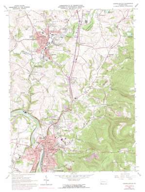
Connellsville Topo Map Pennsylvania
To zoom in, hover over the map of Connellsville
USGS Topo Quad 40079a5 - 1:24,000 scale
| Topo Map Name: | Connellsville |
| USGS Topo Quad ID: | 40079a5 |
| Print Size: | ca. 21 1/4" wide x 27" high |
| Southeast Coordinates: | 40° N latitude / 79.5° W longitude |
| Map Center Coordinates: | 40.0625° N latitude / 79.5625° W longitude |
| U.S. State: | PA |
| Filename: | o40079a5.jpg |
| Download Map JPG Image: | Connellsville topo map 1:24,000 scale |
| Map Type: | Topographic |
| Topo Series: | 7.5´ |
| Map Scale: | 1:24,000 |
| Source of Map Images: | United States Geological Survey (USGS) |
| Alternate Map Versions: |
Connellsville PA 1964, updated 1966 Download PDF Buy paper map Connellsville PA 1964, updated 1973 Download PDF Buy paper map Connellsville PA 1964, updated 1973 Download PDF Buy paper map Connellsville PA 1964, updated 1977 Download PDF Buy paper map Connellsville PA 1964, updated 1977 Download PDF Buy paper map Connellsville PA 2010 Download PDF Buy paper map Connellsville PA 2013 Download PDF Buy paper map Connellsville PA 2016 Download PDF Buy paper map |
1:24,000 Topo Quads surrounding Connellsville
> Back to 40079a1 at 1:100,000 scale
> Back to 40078a1 at 1:250,000 scale
> Back to U.S. Topo Maps home
Connellsville topo map: Gazetteer
Connellsville: Airports
Campbell Airport elevation 346m 1135′Green Acres Heliport elevation 346m 1135′
Mount Pleasant-Scottdale Airport elevation 346m 1135′
Penn Line Service Airport elevation 316m 1036′
W P H S Airport elevation 328m 1076′
Connellsville: Dams
Green Lick Dam elevation 381m 1250′Greenlick Run Dam elevation 321m 1053′
Connellsville: Parks
Lake Forest Park elevation 331m 1085′Loucks Park elevation 322m 1056′
Mount Vernon Park elevation 358m 1174′
Connellsville: Populated Places
Adelaide elevation 268m 879′Breakneck elevation 353m 1158′
Broad Ford elevation 263m 862′
Buckeye elevation 328m 1076′
Coldbrook elevation 293m 961′
Connellsville elevation 289m 948′
Crossland elevation 294m 964′
Dry Hill elevation 357m 1171′
Everson elevation 324m 1062′
Greenwood Heights elevation 320m 1049′
Hammondville elevation 335m 1099′
Hawkeye elevation 343m 1125′
Iron Bridge elevation 319m 1046′
Keifertown elevation 328m 1076′
Kingview elevation 333m 1092′
McClure elevation 334m 1095′
Miedel Hill elevation 367m 1204′
Morgan elevation 292m 958′
Mount Nebo elevation 366m 1200′
Moyer elevation 289m 948′
New Haven elevation 313m 1026′
North Manor elevation 266m 872′
North Scottdale elevation 322m 1056′
Owensdale elevation 325m 1066′
Pennsville elevation 326m 1069′
Pinetree elevation 349m 1145′
Pleasant Hill elevation 669m 2194′
Pleasant Valley elevation 411m 1348′
Poplar Grove elevation 309m 1013′
Prittstown elevation 350m 1148′
Scottdale elevation 317m 1040′
Snydertown elevation 341m 1118′
Thornwood elevation 323m 1059′
Trotter elevation 300m 984′
Walnut Hill elevation 380m 1246′
West Overton elevation 338m 1108′
Wheeler elevation 315m 1033′
Woddale elevation 321m 1053′
Connellsville: Reservoirs
Bridgeport Reservoir elevation 321m 1053′Green Lick Reservoir elevation 381m 1250′
Pa-656 Reservoir elevation 321m 1053′
Connellsville: Streams
Breakneck Run elevation 307m 1007′Connell Run elevation 267m 875′
Dunbar Creek elevation 268m 879′
Galley Run elevation 267m 875′
Green Lick Run elevation 317m 1040′
Irish Run elevation 293m 961′
Latta Run elevation 328m 1076′
Mounts Creek elevation 268m 879′
Opossum Run elevation 262m 859′
Sherrick Run elevation 309m 1013′
Spruce Run elevation 313m 1026′
Stauffer Run elevation 313m 1026′
Whites Run elevation 293m 961′
Connellsville: Summits
Bark Hill elevation 401m 1315′Ore Mine Hill elevation 500m 1640′
Connellsville: Valleys
Mock Hollow elevation 315m 1033′Polecat Hollow elevation 407m 1335′
Spruce Hollow elevation 397m 1302′
Trump Hollow elevation 340m 1115′
Connellsville digital topo map on disk
Buy this Connellsville topo map showing relief, roads, GPS coordinates and other geographical features, as a high-resolution digital map file on DVD:


