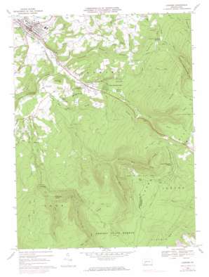
Ligonier Topo Map Pennsylvania
To zoom in, hover over the map of Ligonier
USGS Topo Quad 40079b2 - 1:24,000 scale
| Topo Map Name: | Ligonier |
| USGS Topo Quad ID: | 40079b2 |
| Print Size: | ca. 21 1/4" wide x 27" high |
| Southeast Coordinates: | 40.125° N latitude / 79.125° W longitude |
| Map Center Coordinates: | 40.1875° N latitude / 79.1875° W longitude |
| U.S. State: | PA |
| Filename: | o40079b2.jpg |
| Download Map JPG Image: | Ligonier topo map 1:24,000 scale |
| Map Type: | Topographic |
| Topo Series: | 7.5´ |
| Map Scale: | 1:24,000 |
| Source of Map Images: | United States Geological Survey (USGS) |
| Alternate Map Versions: |
Ligonier PA 1967, updated 1971 Download PDF Buy paper map Ligonier PA 1967, updated 1973 Download PDF Buy paper map Ligonier PA 1967, updated 1983 Download PDF Buy paper map Ligonier PA 1967, updated 1983 Download PDF Buy paper map Ligonier PA 1977, updated 1979 Download PDF Buy paper map Ligonier PA 2010 Download PDF Buy paper map Ligonier PA 2013 Download PDF Buy paper map Ligonier PA 2016 Download PDF Buy paper map |
1:24,000 Topo Quads surrounding Ligonier
> Back to 40079a1 at 1:100,000 scale
> Back to 40078a1 at 1:250,000 scale
> Back to U.S. Topo Maps home
Ligonier topo map: Gazetteer
Ligonier: Bars
Flat Rock elevation 460m 1509′Ligonier: Cliffs
Beam Rocks elevation 810m 2657′Ninety Foot Rocks elevation 629m 2063′
Wolf Rocks elevation 798m 2618′
Ligonier: Dams
Ligonier Dam elevation 508m 1666′Ligonier: Falls
Adams Falls elevation 500m 1640′Ligonier: Forests
Forbes State Forest elevation 828m 2716′Ligonier: Mines
Bluestone Quarry elevation 676m 2217′Ligonier: Parks
Laurel Mountain Park elevation 443m 1453′Laurel Mountain State Park elevation 830m 2723′
Linn Run State Park elevation 548m 1797′
Ligonier: Populated Places
California Furnace elevation 440m 1443′Laughlintown elevation 392m 1286′
Laurel Mountain Park elevation 433m 1420′
Laurel Mountain Village elevation 818m 2683′
Ligonier elevation 365m 1197′
Rector elevation 396m 1299′
Shirley elevation 371m 1217′
Thomas Crossroads elevation 489m 1604′
Ligonier: Reservoirs
Duck Pond elevation 390m 1279′Lake Tod elevation 476m 1561′
Ligonier Reservoir elevation 452m 1482′
Ligonier Township Reservoir elevation 507m 1663′
Ligonier: Springs
Grove Run Spring elevation 564m 1850′Ligonier: Streams
Bear Creek elevation 520m 1706′Fish Run elevation 705m 2312′
Furnace Run elevation 424m 1391′
Grove Run elevation 535m 1755′
Laughlintown Run elevation 358m 1174′
Left Fork Mill Creek elevation 541m 1774′
Linn Run elevation 373m 1223′
McCullen Run elevation 419m 1374′
Naugle Run elevation 375m 1230′
Right Fork Mill Creek elevation 534m 1751′
Rock Run elevation 511m 1676′
Rolling Rock Creek elevation 365m 1197′
Zimmerman Run elevation 359m 1177′
Ligonier: Summits
Club House Hill elevation 482m 1581′Gravel Hill elevation 519m 1702′
Heinz Hill elevation 489m 1604′
Parks Hill elevation 854m 2801′
Pea Vine Hill elevation 886m 2906′
Penrod Hill elevation 855m 2805′
Peyton Hill elevation 595m 1952′
Reed Hill elevation 812m 2664′
Scaife Hill elevation 517m 1696′
Sheep Hill elevation 641m 2103′
Shooters Hill elevation 471m 1545′
Ulery Hill elevation 863m 2831′
Ligonier: Trails
Brant Trail elevation 679m 2227′Darr Trail elevation 647m 2122′
East End Trail elevation 750m 2460′
Spruce Run Trail elevation 746m 2447′
Wolf Rocks Trail elevation 822m 2696′
Ligonier: Valleys
Lettie Shaffer Hollow elevation 364m 1194′Silver Mine Hollow elevation 494m 1620′
Wrinkle Hollow elevation 672m 2204′
Ligonier digital topo map on disk
Buy this Ligonier topo map showing relief, roads, GPS coordinates and other geographical features, as a high-resolution digital map file on DVD:


