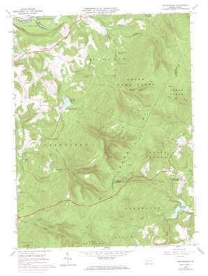
Rachelwood Topo Map Pennsylvania
To zoom in, hover over the map of Rachelwood
USGS Topo Quad 40079c1 - 1:24,000 scale
| Topo Map Name: | Rachelwood |
| USGS Topo Quad ID: | 40079c1 |
| Print Size: | ca. 21 1/4" wide x 27" high |
| Southeast Coordinates: | 40.25° N latitude / 79° W longitude |
| Map Center Coordinates: | 40.3125° N latitude / 79.0625° W longitude |
| U.S. State: | PA |
| Filename: | o40079c1.jpg |
| Download Map JPG Image: | Rachelwood topo map 1:24,000 scale |
| Map Type: | Topographic |
| Topo Series: | 7.5´ |
| Map Scale: | 1:24,000 |
| Source of Map Images: | United States Geological Survey (USGS) |
| Alternate Map Versions: |
Rachelwood PA 1964, updated 1966 Download PDF Buy paper map Rachelwood PA 1964, updated 1973 Download PDF Buy paper map Rachelwood PA 1964, updated 1974 Download PDF Buy paper map Rachelwood PA 1973, updated 1984 Download PDF Buy paper map Rachelwood PA 1977, updated 1979 Download PDF Buy paper map Rachelwood PA 1998, updated 2000 Download PDF Buy paper map Rachelwood PA 2010 Download PDF Buy paper map Rachelwood PA 2013 Download PDF Buy paper map Rachelwood PA 2016 Download PDF Buy paper map |
1:24,000 Topo Quads surrounding Rachelwood
> Back to 40079a1 at 1:100,000 scale
> Back to 40078a1 at 1:250,000 scale
> Back to U.S. Topo Maps home
Rachelwood topo map: Gazetteer
Rachelwood: Dams
North Fork Dam elevation 466m 1528′Tubmill Dam elevation 404m 1325′
Rachelwood: Lakes
Echo Lake elevation 396m 1299′Rachelwood: Parks
Laurel Ridge State Park elevation 853m 2798′Ross Mountain elevation 406m 1332′
Rachelwood: Populated Places
Baldwin Furnace elevation 438m 1437′Rachelwood elevation 572m 1876′
Rachelwood: Reservoirs
Mirror Lake elevation 342m 1122′New Florence Reservoir elevation 411m 1348′
North Fork Reservoir elevation 470m 1541′
Tubmill Reservoir elevation 404m 1325′
Rachelwood: Streams
Allwine Creek elevation 469m 1538′Lick Run elevation 404m 1325′
O'Connor Run elevation 608m 1994′
Poplar Run elevation 400m 1312′
Powdermill Run elevation 405m 1328′
Riffle Run elevation 466m 1528′
Shannon Run elevation 317m 1040′
Rachelwood digital topo map on disk
Buy this Rachelwood topo map showing relief, roads, GPS coordinates and other geographical features, as a high-resolution digital map file on DVD:


