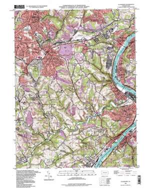
Glassport Topo Map Pennsylvania
To zoom in, hover over the map of Glassport
USGS Topo Quad 40079c8 - 1:24,000 scale
| Topo Map Name: | Glassport |
| USGS Topo Quad ID: | 40079c8 |
| Print Size: | ca. 21 1/4" wide x 27" high |
| Southeast Coordinates: | 40.25° N latitude / 79.875° W longitude |
| Map Center Coordinates: | 40.3125° N latitude / 79.9375° W longitude |
| U.S. State: | PA |
| Filename: | o40079c8.jpg |
| Download Map JPG Image: | Glassport topo map 1:24,000 scale |
| Map Type: | Topographic |
| Topo Series: | 7.5´ |
| Map Scale: | 1:24,000 |
| Source of Map Images: | United States Geological Survey (USGS) |
| Alternate Map Versions: |
Glassport PA 1953, updated 1955 Download PDF Buy paper map Glassport PA 1960, updated 1961 Download PDF Buy paper map Glassport PA 1960, updated 1967 Download PDF Buy paper map Glassport PA 1960, updated 1971 Download PDF Buy paper map Glassport PA 1960, updated 1980 Download PDF Buy paper map Glassport PA 1988, updated 1998 Download PDF Buy paper map Glassport PA 2010 Download PDF Buy paper map Glassport PA 2013 Download PDF Buy paper map Glassport PA 2016 Download PDF Buy paper map |
1:24,000 Topo Quads surrounding Glassport
> Back to 40079a1 at 1:100,000 scale
> Back to 40078a1 at 1:250,000 scale
> Back to U.S. Topo Maps home
Glassport topo map: Gazetteer
Glassport: Airports
Allegheny County Airport elevation 375m 1230′Replogle Airport elevation 326m 1069′
Glassport: Dams
Dam Number Three elevation 217m 711′Monongahela River Locks and Dam Three elevation 219m 718′
Glassport: Parks
Mowry Park elevation 324m 1062′Prospect Park elevation 351m 1151′
Glassport: Populated Places
Baldwin elevation 349m 1145′Blaine Hill elevation 277m 908′
Brentwood elevation 360m 1181′
Broughton elevation 302m 990′
Bruceton elevation 293m 961′
Camden elevation 258m 846′
Clairton elevation 276m 905′
Coal Valley elevation 241m 790′
Cochrans Mill elevation 334m 1095′
Curry elevation 308m 1010′
Dravosburg elevation 220m 721′
East Elizabeth elevation 227m 744′
Elizabeth elevation 235m 770′
Elrama elevation 255m 836′
Experiment elevation 296m 971′
Floreffe elevation 244m 800′
Gastonville elevation 298m 977′
Gill Hall elevation 355m 1164′
Glassport elevation 233m 764′
Horning elevation 313m 1026′
Jefferson Hills elevation 315m 1033′
Lincoln Place elevation 351m 1151′
Mendelssohn elevation 274m 898′
Mifflin Junction elevation 362m 1187′
New England elevation 299m 980′
Option elevation 327m 1072′
Otto elevation 241m 790′
Pierce elevation 351m 1151′
Piney Fork elevation 308m 1010′
Pleasant Hills elevation 374m 1227′
Snowden elevation 284m 931′
Surgeon Hall elevation 337m 1105′
West Elizabeth elevation 228m 748′
Whitehall elevation 382m 1253′
Willock elevation 307m 1007′
Wilson elevation 230m 754′
Wylie elevation 227m 744′
Glassport: Post Offices
Clairton Post Office elevation 285m 935′Dravosburg Post Office elevation 260m 853′
Elizabeth Post Office elevation 225m 738′
Elrama Post Office elevation 248m 813′
Epton Post Office (historical) elevation 284m 931′
Floreffe Post Office elevation 244m 800′
Glassport Post Office elevation 229m 751′
Large Post Office elevation 247m 810′
Option Post Office (historical) elevation 327m 1072′
Glassport: Reservoirs
Monongahela River Pool Three elevation 219m 718′Glassport: Streams
Beam Run elevation 234m 767′Catfish Run elevation 281m 921′
Fallen Timber Run elevation 218m 715′
Lewis Run elevation 232m 761′
Lick Run elevation 243m 797′
Lobbs Run elevation 219m 718′
Perry Mill Run elevation 223m 731′
Peters Creek elevation 222m 728′
Piney Fork elevation 254m 833′
Smiths Run elevation 221m 725′
Wylie Run elevation 219m 718′
Glassport: Summits
Pollocks Knob elevation 407m 1335′Glassport: Valleys
Calamity Hollow elevation 219m 718′Pangburn Hollow elevation 226m 741′
Glassport digital topo map on disk
Buy this Glassport topo map showing relief, roads, GPS coordinates and other geographical features, as a high-resolution digital map file on DVD:


