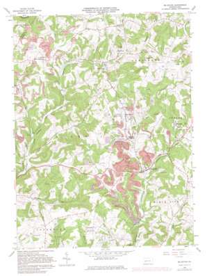
Mcintyre Topo Map Pennsylvania
To zoom in, hover over the map of Mcintyre
USGS Topo Quad 40079e3 - 1:24,000 scale
| Topo Map Name: | Mcintyre |
| USGS Topo Quad ID: | 40079e3 |
| Print Size: | ca. 21 1/4" wide x 27" high |
| Southeast Coordinates: | 40.5° N latitude / 79.25° W longitude |
| Map Center Coordinates: | 40.5625° N latitude / 79.3125° W longitude |
| U.S. State: | PA |
| Filename: | o40079e3.jpg |
| Download Map JPG Image: | Mcintyre topo map 1:24,000 scale |
| Map Type: | Topographic |
| Topo Series: | 7.5´ |
| Map Scale: | 1:24,000 |
| Source of Map Images: | United States Geological Survey (USGS) |
| Alternate Map Versions: |
Mc Intyre PA 1964, updated 1966 Download PDF Buy paper map Mc Intyre PA 1964, updated 1974 Download PDF Buy paper map Mc Intyre PA 1964, updated 1982 Download PDF Buy paper map Mc Intyre PA 1964, updated 1982 Download PDF Buy paper map McIntyre PA 2010 Download PDF Buy paper map McIntyre PA 2013 Download PDF Buy paper map McIntyre PA 2016 Download PDF Buy paper map |
1:24,000 Topo Quads surrounding Mcintyre
> Back to 40079e1 at 1:100,000 scale
> Back to 40078a1 at 1:250,000 scale
> Back to U.S. Topo Maps home
Mcintyre topo map: Gazetteer
Mcintyre: Populated Places
Aultman elevation 341m 1118′Coal Run elevation 334m 1095′
J M Junction elevation 352m 1154′
Jacksonville elevation 330m 1082′
Lewisville elevation 406m 1332′
McIntyre elevation 356m 1167′
Parkwood elevation 400m 1312′
West Lebanon elevation 399m 1309′
Mcintyre: Post Offices
Clune Post Office elevation 333m 1092′Kent Post Office elevation 333m 1092′
Mcintyre: Reservoirs
Green Valley Lake elevation 352m 1154′Mcintyre: Streams
Coal Run elevation 304m 997′Hooper Run elevation 282m 925′
Neal Run elevation 332m 1089′
Nesbit Run elevation 279m 915′
Reeds Run elevation 323m 1059′
Whisky Run elevation 290m 951′
Mcintyre: Summits
Watts Hill elevation 481m 1578′Mcintyre digital topo map on disk
Buy this Mcintyre topo map showing relief, roads, GPS coordinates and other geographical features, as a high-resolution digital map file on DVD:


