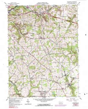
Saxonburg Topo Map Pennsylvania
To zoom in, hover over the map of Saxonburg
USGS Topo Quad 40079g7 - 1:24,000 scale
| Topo Map Name: | Saxonburg |
| USGS Topo Quad ID: | 40079g7 |
| Print Size: | ca. 21 1/4" wide x 27" high |
| Southeast Coordinates: | 40.75° N latitude / 79.75° W longitude |
| Map Center Coordinates: | 40.8125° N latitude / 79.8125° W longitude |
| U.S. State: | PA |
| Filename: | o40079g7.jpg |
| Download Map JPG Image: | Saxonburg topo map 1:24,000 scale |
| Map Type: | Topographic |
| Topo Series: | 7.5´ |
| Map Scale: | 1:24,000 |
| Source of Map Images: | United States Geological Survey (USGS) |
| Alternate Map Versions: |
Saxonburg PA 1958, updated 1959 Download PDF Buy paper map Saxonburg PA 1958, updated 1970 Download PDF Buy paper map Saxonburg PA 1958, updated 1991 Download PDF Buy paper map Saxonburg PA 1958, updated 1991 Download PDF Buy paper map Saxonburg PA 2010 Download PDF Buy paper map Saxonburg PA 2013 Download PDF Buy paper map Saxonburg PA 2016 Download PDF Buy paper map |
1:24,000 Topo Quads surrounding Saxonburg
> Back to 40079e1 at 1:100,000 scale
> Back to 40078a1 at 1:250,000 scale
> Back to U.S. Topo Maps home
Saxonburg topo map: Gazetteer
Saxonburg: Dams
Lake Saxony Dam elevation 387m 1269′Saxonburg: Populated Places
Bonnie Brook elevation 327m 1072′Brinker elevation 391m 1282′
Cabot elevation 365m 1197′
Carbon Center elevation 343m 1125′
Frazier Mill elevation 325m 1066′
Great Belt elevation 382m 1253′
Hannahstown elevation 424m 1391′
Herman elevation 390m 1279′
Jefferson Center elevation 342m 1122′
Marwood elevation 373m 1223′
Saxonburg elevation 395m 1295′
Vogleyville elevation 319m 1046′
Wadsworth elevation 324m 1062′
Saxonburg: Reservoirs
Lake Saxony elevation 387m 1269′Saxonburg: Streams
Bonnie Brook elevation 305m 1000′Vaur Run elevation 334m 1095′
Saxonburg digital topo map on disk
Buy this Saxonburg topo map showing relief, roads, GPS coordinates and other geographical features, as a high-resolution digital map file on DVD:


