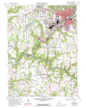
Butler Topo Map Pennsylvania
To zoom in, hover over the map of Butler
USGS Topo Quad 40079g8 - 1:24,000 scale
| Topo Map Name: | Butler |
| USGS Topo Quad ID: | 40079g8 |
| Print Size: | ca. 21 1/4" wide x 27" high |
| Southeast Coordinates: | 40.75° N latitude / 79.875° W longitude |
| Map Center Coordinates: | 40.8125° N latitude / 79.9375° W longitude |
| U.S. State: | PA |
| Filename: | o40079g8.jpg |
| Download Map JPG Image: | Butler topo map 1:24,000 scale |
| Map Type: | Topographic |
| Topo Series: | 7.5´ |
| Map Scale: | 1:24,000 |
| Source of Map Images: | United States Geological Survey (USGS) |
| Alternate Map Versions: |
Butler PA 1958 Download PDF Buy paper map Butler PA 1958, updated 1959 Download PDF Buy paper map Butler PA 1958, updated 1970 Download PDF Buy paper map Butler PA 2010 Download PDF Buy paper map Butler PA 2013 Download PDF Buy paper map Butler PA 2016 Download PDF Buy paper map |
1:24,000 Topo Quads surrounding Butler
> Back to 40079e1 at 1:100,000 scale
> Back to 40078a1 at 1:250,000 scale
> Back to U.S. Topo Maps home
Butler topo map: Gazetteer
Butler: Airports
Butler Farm Show Roe Airport elevation 396m 1299′Butler-Graham Airport elevation 379m 1243′
Calmwood Airport elevation 389m 1276′
Butler: Dams
Sawmill Run Dam elevation 320m 1049′Butler: Populated Places
Bredinville elevation 319m 1046′Brownsdale elevation 351m 1151′
Butler elevation 316m 1036′
Highfield elevation 391m 1282′
Homeacre elevation 371m 1217′
Lyndora elevation 368m 1207′
McBride elevation 301m 987′
McCalmont elevation 301m 987′
Meadowood elevation 398m 1305′
Meharg elevation 309m 1013′
Meridian elevation 388m 1272′
Nixon elevation 372m 1220′
North Butler elevation 328m 1076′
Oak Hills elevation 373m 1223′
Renfrew elevation 298m 977′
Ribold elevation 296m 971′
Rockdale elevation 317m 1040′
Butler: Reservoirs
Sawmill Run Reservoir elevation 320m 1049′Butler: Streams
Butcher Run elevation 298m 977′Coal Run elevation 305m 1000′
Patterson Run elevation 304m 997′
Robinson Run elevation 303m 994′
Rocklick Run elevation 299m 980′
Sawmill Run elevation 297m 974′
Sullivan Run elevation 299m 980′
Thorn Creek elevation 291m 954′
Butler digital topo map on disk
Buy this Butler topo map showing relief, roads, GPS coordinates and other geographical features, as a high-resolution digital map file on DVD:


