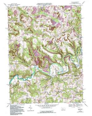
Valier Topo Map Pennsylvania
To zoom in, hover over the map of Valier
USGS Topo Quad 40079h1 - 1:24,000 scale
| Topo Map Name: | Valier |
| USGS Topo Quad ID: | 40079h1 |
| Print Size: | ca. 21 1/4" wide x 27" high |
| Southeast Coordinates: | 40.875° N latitude / 79° W longitude |
| Map Center Coordinates: | 40.9375° N latitude / 79.0625° W longitude |
| U.S. State: | PA |
| Filename: | o40079h1.jpg |
| Download Map JPG Image: | Valier topo map 1:24,000 scale |
| Map Type: | Topographic |
| Topo Series: | 7.5´ |
| Map Scale: | 1:24,000 |
| Source of Map Images: | United States Geological Survey (USGS) |
| Alternate Map Versions: |
Valier PA 1968, updated 1970 Download PDF Buy paper map Valier PA 1968, updated 1975 Download PDF Buy paper map Valier PA 1968, updated 1982 Download PDF Buy paper map Valier PA 1968, updated 1993 Download PDF Buy paper map Valier PA 2010 Download PDF Buy paper map Valier PA 2014 Download PDF Buy paper map Valier PA 2016 Download PDF Buy paper map |
1:24,000 Topo Quads surrounding Valier
> Back to 40079e1 at 1:100,000 scale
> Back to 40078a1 at 1:250,000 scale
> Back to U.S. Topo Maps home
Valier topo map: Gazetteer
Valier: Airports
Stockdale Mine Supply Heliport elevation 491m 1610′Wainwrights Landing Strip elevation 441m 1446′
Valier: Mines
Mine Number 8 elevation 462m 1515′Valier: Populated Places
Covode elevation 469m 1538′Fordham elevation 367m 1204′
Frostburg elevation 456m 1496′
Hamilton elevation 362m 1187′
Horatio elevation 377m 1236′
Oliveburg elevation 489m 1604′
Sportsburg elevation 372m 1220′
Trade City elevation 454m 1489′
Valier elevation 385m 1263′
Valier: Springs
Granny Coon Spring elevation 378m 1240′Valier: Streams
Crossman Run elevation 364m 1194′Dutch Run elevation 360m 1181′
Foundry Run elevation 354m 1161′
McCracken Run elevation 397m 1302′
Nicely Run elevation 354m 1161′
Perryville Run elevation 359m 1177′
Rose Run elevation 360m 1181′
Valier digital topo map on disk
Buy this Valier topo map showing relief, roads, GPS coordinates and other geographical features, as a high-resolution digital map file on DVD:


