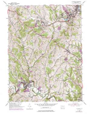
Ellsworth Topo Map Pennsylvania
To zoom in, hover over the map of Ellsworth
USGS Topo Quad 40080a1 - 1:24,000 scale
| Topo Map Name: | Ellsworth |
| USGS Topo Quad ID: | 40080a1 |
| Print Size: | ca. 21 1/4" wide x 27" high |
| Southeast Coordinates: | 40° N latitude / 80° W longitude |
| Map Center Coordinates: | 40.0625° N latitude / 80.0625° W longitude |
| U.S. State: | PA |
| Filename: | o40080a1.jpg |
| Download Map JPG Image: | Ellsworth topo map 1:24,000 scale |
| Map Type: | Topographic |
| Topo Series: | 7.5´ |
| Map Scale: | 1:24,000 |
| Source of Map Images: | United States Geological Survey (USGS) |
| Alternate Map Versions: |
Ellsworth PA 1954, updated 1955 Download PDF Buy paper map Ellsworth PA 1954, updated 1968 Download PDF Buy paper map Ellsworth PA 1954, updated 1970 Download PDF Buy paper map Ellsworth PA 1954, updated 1979 Download PDF Buy paper map Ellsworth PA 1954, updated 1979 Download PDF Buy paper map Ellsworth PA 2010 Download PDF Buy paper map Ellsworth PA 2013 Download PDF Buy paper map Ellsworth PA 2016 Download PDF Buy paper map |
1:24,000 Topo Quads surrounding Ellsworth
> Back to 40080a1 at 1:100,000 scale
> Back to 40080a1 at 1:250,000 scale
> Back to U.S. Topo Maps home
Ellsworth topo map: Gazetteer
Ellsworth: Airports
Home Base Airport elevation 342m 1122′Horne Airport elevation 312m 1023′
Ellsworth: Dams
Cokeburg Water Supply Dam elevation 327m 1072′Cokeburg Water Supply Dam elevation 338m 1108′
Ellsworth Number Two Dam elevation 293m 961′
Mine 51 Pond Three Dam elevation 313m 1026′
Somerset Number Sixty Dam elevation 293m 961′
Somerset Number Sixty Pond E Dam elevation 318m 1043′
Ellsworth: Lakes
Steves Lake elevation 334m 1095′Ellsworth: Parks
State Game Lands Number 297 elevation 343m 1125′Ellsworth: Populated Places
Beallsville elevation 347m 1138′Bentleyville elevation 291m 954′
Cokeburg elevation 348m 1141′
Cokeburg Junction elevation 300m 984′
Deemston elevation 349m 1145′
East Marianna elevation 270m 885′
Ellsworth elevation 304m 997′
Fairfield elevation 269m 882′
Fredericktown Hill elevation 281m 921′
Hillsboro elevation 364m 1194′
Little Summit elevation 409m 1341′
Marianna elevation 320m 1049′
North Fredericktown elevation 290m 951′
Odell elevation 403m 1322′
Old Zollarsville elevation 263m 862′
Ontario elevation 320m 1049′
Pleasant View Heights elevation 420m 1377′
Richeyville elevation 364m 1194′
Scenery Hill elevation 423m 1387′
Turkeyfoot elevation 384m 1259′
Van Voorhis Hill elevation 423m 1387′
West Zollarsville elevation 267m 875′
Ellsworth: Post Offices
Bentleyville Post Office elevation 289m 948′Ellsworth: Reservoirs
Active Sludge Pond elevation 313m 1026′Cokeburg Reservoir elevation 327m 1072′
Ellsworth Reservoir elevation 293m 961′
Pond E elevation 318m 1043′
Pond F elevation 293m 961′
Ellsworth: Streams
Barrs Run elevation 260m 853′Center Branch Pigeon Creek elevation 303m 994′
Daniels Run elevation 264m 866′
Horn Run elevation 266m 872′
Little Daniels Run elevation 266m 872′
Patterson Run elevation 265m 869′
Plum Run elevation 254m 833′
South Branch Pigeon Creek elevation 303m 994′
Ellsworth: Summits
Spring Hill elevation 366m 1200′Ellsworth digital topo map on disk
Buy this Ellsworth topo map showing relief, roads, GPS coordinates and other geographical features, as a high-resolution digital map file on DVD:


