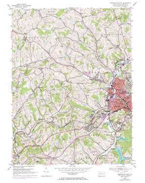
Washington West Topo Map Pennsylvania
To zoom in, hover over the map of Washington West
USGS Topo Quad 40080b3 - 1:24,000 scale
| Topo Map Name: | Washington West |
| USGS Topo Quad ID: | 40080b3 |
| Print Size: | ca. 21 1/4" wide x 27" high |
| Southeast Coordinates: | 40.125° N latitude / 80.25° W longitude |
| Map Center Coordinates: | 40.1875° N latitude / 80.3125° W longitude |
| U.S. State: | PA |
| Filename: | o40080b3.jpg |
| Download Map JPG Image: | Washington West topo map 1:24,000 scale |
| Map Type: | Topographic |
| Topo Series: | 7.5´ |
| Map Scale: | 1:24,000 |
| Source of Map Images: | United States Geological Survey (USGS) |
| Alternate Map Versions: |
Washington West PA 1954, updated 1955 Download PDF Buy paper map Washington West PA 1954, updated 1966 Download PDF Buy paper map Washington West PA 1954, updated 1970 Download PDF Buy paper map Washington West PA 1993, updated 1999 Download PDF Buy paper map Washington West PA 2010 Download PDF Buy paper map Washington West PA 2013 Download PDF Buy paper map Washington West PA 2016 Download PDF Buy paper map |
1:24,000 Topo Quads surrounding Washington West
> Back to 40080a1 at 1:100,000 scale
> Back to 40080a1 at 1:250,000 scale
> Back to U.S. Topo Maps home
Washington West topo map: Gazetteer
Washington West: Airports
Washington County Airport elevation 358m 1174′Washington West: Dams
Dam Number Three elevation 326m 1069′Water Company Dam Number Four elevation 327m 1072′
Washington West: Populated Places
Arden elevation 300m 984′Arden Mines elevation 319m 1046′
Bellevue elevation 361m 1184′
Buffalo elevation 391m 1282′
Coffeys Crossing elevation 322m 1056′
Elwood Park elevation 345m 1131′
Finney elevation 359m 1177′
Franklin Farms elevation 327m 1072′
Gabby Heights elevation 340m 1115′
Gretna elevation 351m 1151′
Lincoln Hill elevation 367m 1204′
Log Pile elevation 345m 1131′
Oak Grove elevation 308m 1010′
Patton elevation 376m 1233′
Rural Valley elevation 338m 1108′
Sugar Hill elevation 420m 1377′
Taylorstown Station elevation 313m 1026′
Tylerdale elevation 349m 1145′
Wolfdale elevation 321m 1053′
Washington West: Reservoirs
Number Four Reservoir elevation 339m 1112′Number One Reservoir elevation 314m 1030′
Number Three Reservoir elevation 328m 1076′
Number Two Reservoir elevation 311m 1020′
Reservoir Number Four elevation 327m 1072′
Reservoir Number Three elevation 326m 1069′
Washington West: Streams
Catfish Creek elevation 303m 994′Georges Run elevation 300m 984′
Washington West: Summits
Cemetery Hill elevation 397m 1302′Garrett Hill elevation 420m 1377′
Washington West: Tunnels
Finney Tunnel elevation 398m 1305′Washington West: Valleys
Pleasant Valley elevation 311m 1020′Washington West digital topo map on disk
Buy this Washington West topo map showing relief, roads, GPS coordinates and other geographical features, as a high-resolution digital map file on DVD:


