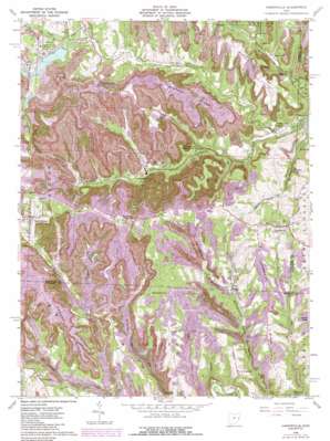
Harrisville Topo Map Ohio
To zoom in, hover over the map of Harrisville
USGS Topo Quad 40080b8 - 1:24,000 scale
| Topo Map Name: | Harrisville |
| USGS Topo Quad ID: | 40080b8 |
| Print Size: | ca. 21 1/4" wide x 27" high |
| Southeast Coordinates: | 40.125° N latitude / 80.875° W longitude |
| Map Center Coordinates: | 40.1875° N latitude / 80.9375° W longitude |
| U.S. State: | OH |
| Filename: | o40080b8.jpg |
| Download Map JPG Image: | Harrisville topo map 1:24,000 scale |
| Map Type: | Topographic |
| Topo Series: | 7.5´ |
| Map Scale: | 1:24,000 |
| Source of Map Images: | United States Geological Survey (USGS) |
| Alternate Map Versions: |
Harrisville OH 1960, updated 1961 Download PDF Buy paper map Harrisville OH 1960, updated 1968 Download PDF Buy paper map Harrisville OH 1960, updated 1973 Download PDF Buy paper map Harrisville OH 1960, updated 1978 Download PDF Buy paper map Harrisville OH 1960, updated 1985 Download PDF Buy paper map Harrisville OH 2010 Download PDF Buy paper map Harrisville OH 2013 Download PDF Buy paper map Harrisville OH 2016 Download PDF Buy paper map |
1:24,000 Topo Quads surrounding Harrisville
> Back to 40080a1 at 1:100,000 scale
> Back to 40080a1 at 1:250,000 scale
> Back to U.S. Topo Maps home
Harrisville topo map: Gazetteer
Harrisville: Bends
Fox Bottom elevation 292m 958′Harrisville: Dams
Bassage Lake Dam elevation 321m 1053′Bradford Dam elevation 330m 1082′
Consoldiation Coal Company Pond 0107-034 Dam elevation 346m 1135′
Consolidation Coal Company Dam 0107-013 elevation 335m 1099′
Georgetown Plant Lower Supply Dam elevation 326m 1069′
Georgetown Plant Upper Supply Dam elevation 328m 1076′
Georgetown Upper Dam Number One elevation 335m 1099′
Georgetown Upper Dam Number Two elevation 327m 1072′
Seleski Pond Dam elevation 311m 1020′
Harrisville: Mines
Culbertson Drift Mine elevation 333m 1092′D Number 11 Mine elevation 379m 1243′
Decorte Number 2 Mine elevation 371m 1217′
Dickerson Number 10 Mine elevation 349m 1145′
Franklin Number 125 Mine elevation 348m 1141′
Georgetown Mine elevation 347m 1138′
Glen Castle Number 6 Mine elevation 373m 1223′
Glencastle Mine elevation 330m 1082′
Goodyear Mine elevation 362m 1187′
Jamison Mine elevation 359m 1177′
McCoy Mine elevation 364m 1194′
Number 2 Mine elevation 352m 1154′
Robyville Number 80 Drift Number 2 Mine elevation 360m 1181′
Short Creek Number 1 Mine elevation 381m 1250′
Short Creek Number 2 Mine elevation 375m 1230′
Harrisville: Populated Places
Belknap elevation 269m 882′Belleve elevation 279m 915′
Blairmont elevation 282m 925′
Chickwan elevation 279m 915′
Duncanwood elevation 326m 1069′
Georgetown elevation 294m 964′
Ginther (historical) elevation 361m 1184′
Hagan Addition elevation 265m 869′
Hammond Crossroad elevation 379m 1243′
Harrisville elevation 381m 1250′
Horton elevation 315m 1033′
Hurford elevation 280m 918′
Kinsman elevation 354m 1161′
New Athens elevation 361m 1184′
Newtown (historical) elevation 287m 941′
Robyville elevation 285m 935′
Science Hill elevation 362m 1187′
Shepherdstown elevation 378m 1240′
Uniontown elevation 367m 1204′
Wheeling Valley (historical) elevation 317m 1040′
Harrisville: Post Offices
Blairmont Post Office (historical) elevation 280m 918′Duncanwood Post Office (historical) elevation 328m 1076′
Ginther Post Office elevation 365m 1197′
Harrison Post Office elevation 322m 1056′
Hurford Post Office (historical) elevation 280m 918′
New Athens Post Office elevation 361m 1184′
Science Hill Post Office (historical) elevation 356m 1167′
Sheperdstown Post Office (historical) elevation 368m 1207′
Harrisville: Reservoirs
Bassage Lake Dam elevation 321m 1053′Consolidation Coal Company Dam 0107-0 elevation 335m 1099′
Consolidation Coal Company Pond 0107- elevation 315m 1033′
Consolidation Coal Company Pond 0107- elevation 346m 1135′
Georgetown Plant Lower Supply Pond elevation 326m 1069′
Georgetown Plant Upper Supply Pond elevation 328m 1076′
Georgetown Prep Plant Freshwater Lake elevation 318m 1043′
Georgetown Upper Dam Number One Pond elevation 335m 1099′
Georgetown Upper Dam Number Two Pond elevation 327m 1072′
Seleski Pond elevation 311m 1020′
Harrisville: Ridges
Branson Ridge elevation 366m 1200′Campbell Ridge elevation 365m 1197′
Henderson Ridge elevation 369m 1210′
Harrisville: Streams
Campbell Run elevation 289m 948′Coal Run elevation 268m 879′
Flag Run elevation 262m 859′
Liming Creek elevation 317m 1040′
Middle Fork Short Creek elevation 266m 872′
Mill Run elevation 308m 1010′
Patton Run elevation 311m 1020′
Rose Valley Creek elevation 281m 921′
Ross Run elevation 322m 1056′
Ross Run elevation 311m 1020′
Sally Buffalo Creek elevation 294m 964′
South Fork Short Creek elevation 266m 872′
Harrisville: Valleys
Rose Valley elevation 280m 918′Harrisville digital topo map on disk
Buy this Harrisville topo map showing relief, roads, GPS coordinates and other geographical features, as a high-resolution digital map file on DVD:


