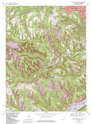
Steubenville West Topo Map Ohio
To zoom in, hover over the map of Steubenville West
USGS Topo Quad 40080c6 - 1:24,000 scale
| Topo Map Name: | Steubenville West |
| USGS Topo Quad ID: | 40080c6 |
| Print Size: | ca. 21 1/4" wide x 27" high |
| Southeast Coordinates: | 40.25° N latitude / 80.625° W longitude |
| Map Center Coordinates: | 40.3125° N latitude / 80.6875° W longitude |
| U.S. States: | OH, WV |
| Filename: | o40080c6.jpg |
| Download Map JPG Image: | Steubenville West topo map 1:24,000 scale |
| Map Type: | Topographic |
| Topo Series: | 7.5´ |
| Map Scale: | 1:24,000 |
| Source of Map Images: | United States Geological Survey (USGS) |
| Alternate Map Versions: |
Steubenville West OH 1958, updated 1959 Download PDF Buy paper map Steubenville West OH 1958, updated 1967 Download PDF Buy paper map Steubenville West OH 1968, updated 1970 Download PDF Buy paper map Steubenville West OH 1968, updated 1978 Download PDF Buy paper map Steubenville West OH 1968, updated 1985 Download PDF Buy paper map Steubenville West OH 1968, updated 1985 Download PDF Buy paper map Steubenville West OH 2011 Download PDF Buy paper map Steubenville West OH 2013 Download PDF Buy paper map Steubenville West OH 2016 Download PDF Buy paper map |
1:24,000 Topo Quads surrounding Steubenville West
> Back to 40080a1 at 1:100,000 scale
> Back to 40080a1 at 1:250,000 scale
> Back to U.S. Topo Maps home
Steubenville West topo map: Gazetteer
Steubenville West: Airports
Jefferson County Airpark elevation 366m 1200′Saint John Medical Center Heliport elevation 365m 1197′
Steubenville West: Dams
Cardinal Fly Ash Retention Dam elevation 303m 994′Malabu Lake Dam elevation 339m 1112′
Steubenville West: Forests
Fernwood State Forest elevation 369m 1210′Steubenville West: Lakes
Lake Betsy elevation 313m 1026′Steubenville West: Parks
Beatty Park Number 1 elevation 257m 843′Harding Stadium elevation 308m 1010′
Steubenville West: Populated Places
Becker Highlands elevation 360m 1181′Brady Estates elevation 322m 1056′
Brentwood Estates elevation 349m 1145′
Brilliant elevation 211m 692′
Dogtown (historical) elevation 347m 1138′
East View elevation 335m 1099′
Fells (historical) elevation 258m 846′
Fernwood elevation 250m 820′
Fishersville elevation 222m 728′
Forest View elevation 348m 1141′
Georges Run elevation 217m 711′
Glendwell elevation 345m 1131′
Gould elevation 207m 679′
Green Acres elevation 357m 1171′
Hillsboro elevation 307m 1007′
Hollywood Addition elevation 300m 984′
Jefferson Heights elevation 348m 1141′
Kolmont elevation 215m 705′
Lincoln Heights elevation 300m 984′
New Alexandria elevation 373m 1223′
Pleasant Heights elevation 295m 967′
Reeds Mill elevation 260m 853′
Spahns Addition elevation 365m 1197′
Steubenville elevation 319m 1046′
Stuart Manor elevation 341m 1118′
Sunshine Park elevation 362m 1187′
Swickards Addition elevation 355m 1164′
Valley Glen elevation 246m 807′
Winterdale elevation 347m 1138′
Steubenville West: Post Offices
Brilliant Post Office elevation 215m 705′Fells Post Office (historical) elevation 254m 833′
Fernwood Post Office (historical) elevation 237m 777′
Georges Run Post Office (historical) elevation 224m 734′
Gould Post Office (historical) elevation 209m 685′
New Alexandria Post Office (historical) elevation 374m 1227′
Reeds Mills Post Office (historical) elevation 267m 875′
Steubenville West: Reservoirs
Cardinal Fly Ash Retention Reservoir elevation 303m 994′Malabu Lake elevation 339m 1112′
Mingo Sportsmens Club Lake Number elevation 322m 1056′
Mingo Sportsmens Club Lake Number elevation 316m 1036′
Steubenville West: Ridges
Buckingham Ridge elevation 366m 1200′Chestnut Ridge elevation 378m 1240′
Steubenville West: Streams
Barbers Run elevation 237m 777′Blockhouse Run elevation 196m 643′
Cedar Lick Run elevation 250m 820′
Dry Fork elevation 207m 679′
Gungeon Hollow Run elevation 240m 787′
Little Salt Run elevation 255m 836′
Long Run elevation 216m 708′
McIntyre Creek elevation 213m 698′
Plum Run elevation 285m 935′
Possum Hollow Run elevation 244m 800′
Riddles Run elevation 202m 662′
Slab Run elevation 274m 898′
Slabcamp Creek elevation 269m 882′
Wells Run elevation 239m 784′
Steubenville West: Tunnels
Adams Tunnel elevation 250m 820′Gould Tunnel elevation 333m 1092′
Hunter Tunnel elevation 303m 994′
Oliver Tunnel elevation 301m 987′
Steubenville West: Valleys
Barbers Hollow elevation 236m 774′Blockhouse Hollow elevation 210m 688′
Erwin Hollow elevation 216m 708′
Gunyon Hollow elevation 239m 784′
Opossum Hollow elevation 247m 810′
Polecat Hollow elevation 267m 875′
Steubenville West digital topo map on disk
Buy this Steubenville West topo map showing relief, roads, GPS coordinates and other geographical features, as a high-resolution digital map file on DVD:


