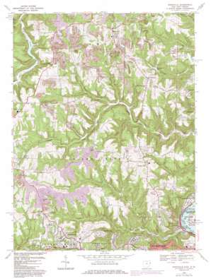
Knoxville Topo Map Ohio
To zoom in, hover over the map of Knoxville
USGS Topo Quad 40080d6 - 1:24,000 scale
| Topo Map Name: | Knoxville |
| USGS Topo Quad ID: | 40080d6 |
| Print Size: | ca. 21 1/4" wide x 27" high |
| Southeast Coordinates: | 40.375° N latitude / 80.625° W longitude |
| Map Center Coordinates: | 40.4375° N latitude / 80.6875° W longitude |
| U.S. States: | OH, WV |
| Filename: | o40080d6.jpg |
| Download Map JPG Image: | Knoxville topo map 1:24,000 scale |
| Map Type: | Topographic |
| Topo Series: | 7.5´ |
| Map Scale: | 1:24,000 |
| Source of Map Images: | United States Geological Survey (USGS) |
| Alternate Map Versions: |
Knoxville OH 1958, updated 1960 Download PDF Buy paper map Knoxville OH 1958, updated 1966 Download PDF Buy paper map Knoxville OH 1968, updated 1970 Download PDF Buy paper map Knoxville OH 1968, updated 1978 Download PDF Buy paper map Knoxville OH 1968, updated 1985 Download PDF Buy paper map Knoxville OH 2010 Download PDF Buy paper map Knoxville OH 2013 Download PDF Buy paper map Knoxville OH 2016 Download PDF Buy paper map |
1:24,000 Topo Quads surrounding Knoxville
> Back to 40080a1 at 1:100,000 scale
> Back to 40080a1 at 1:250,000 scale
> Back to U.S. Topo Maps home
Knoxville topo map: Gazetteer
Knoxville: Airports
Airc Helistop elevation 376m 1233′Eddie Dew Memorial Airpark elevation 328m 1076′
Granatir Airport elevation 364m 1194′
Knoxville: Bars
Wills Creek Bar elevation 197m 646′Knoxville: Dams
Lake Austin Dam elevation 252m 826′Lock and Dam Number 10 (historical) elevation 198m 649′
Knoxville: Lakes
Brandywine Lake elevation 291m 954′Sunset Lake elevation 333m 1092′
Knoxville: Parks
Belleview Municipal Park elevation 323m 1059′Woodview Park elevation 353m 1158′
Knoxville: Populated Places
Alikanna elevation 220m 721′Beechwood elevation 354m 1161′
Beverly Hills elevation 343m 1125′
Buena Vista Heights elevation 358m 1174′
Canellas Park elevation 335m 1099′
Island Creek elevation 250m 820′
Knoxville elevation 395m 1295′
Lake Lodge elevation 357m 1171′
Osage elevation 358m 1174′
Overlook Hills elevation 360m 1181′
Pekin elevation 351m 1151′
Pleasant Hill elevation 352m 1154′
Pleasant Hills Mobile Home Park elevation 352m 1154′
Pottery Addition elevation 210m 688′
Shady Glen elevation 318m 1043′
Stanton Park elevation 224m 734′
Taylortown elevation 375m 1230′
Wallace Heights elevation 354m 1161′
Wintersville elevation 385m 1263′
Knoxville: Post Offices
Alikanna Post Office (historical) elevation 220m 721′Island Creek Post Office (historical) elevation 250m 820′
Knoxville Post Office (historical) elevation 391m 1282′
Osage Post Office (historical) elevation 365m 1197′
Wiintersville Post Office (historical) elevation 376m 1233′
Knoxville: Reservoirs
Lake Austin elevation 252m 826′Knoxville: Streams
Aunt Clara Fork elevation 347m 1138′Cedar Creek elevation 213m 698′
Hale Run elevation 244m 800′
Keyhole Run elevation 244m 800′
North Fork Wills Creek elevation 225m 738′
Rush Run elevation 197m 646′
Shelley Run elevation 249m 816′
South Branch Island Creek elevation 249m 816′
South Branch Wills Creek elevation 225m 738′
Wills Creek elevation 197m 646′
Knoxville: Summits
Norton Hill elevation 408m 1338′Knoxville: Valleys
Dungeon Hollow elevation 258m 846′Egypt Hollow elevation 237m 777′
Knoxville digital topo map on disk
Buy this Knoxville topo map showing relief, roads, GPS coordinates and other geographical features, as a high-resolution digital map file on DVD:


