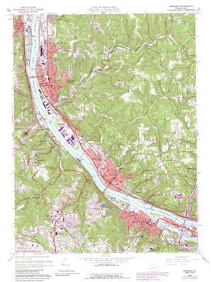
Ambridge Topo Map Pennsylvania
To zoom in, hover over the map of Ambridge
USGS Topo Quad 40080e2 - 1:24,000 scale
| Topo Map Name: | Ambridge |
| USGS Topo Quad ID: | 40080e2 |
| Print Size: | ca. 21 1/4" wide x 27" high |
| Southeast Coordinates: | 40.5° N latitude / 80.125° W longitude |
| Map Center Coordinates: | 40.5625° N latitude / 80.1875° W longitude |
| U.S. State: | PA |
| Filename: | o40080e2.jpg |
| Download Map JPG Image: | Ambridge topo map 1:24,000 scale |
| Map Type: | Topographic |
| Topo Series: | 7.5´ |
| Map Scale: | 1:24,000 |
| Source of Map Images: | United States Geological Survey (USGS) |
| Alternate Map Versions: |
Ambridge PA 1953, updated 1955 Download PDF Buy paper map Ambridge PA 1960, updated 1961 Download PDF Buy paper map Ambridge PA 1960, updated 1966 Download PDF Buy paper map Ambridge PA 1960, updated 1971 Download PDF Buy paper map Ambridge PA 1960, updated 1979 Download PDF Buy paper map Ambridge PA 1960, updated 1988 Download PDF Buy paper map Ambridge PA 1960, updated 1990 Download PDF Buy paper map Ambridge PA 2010 Download PDF Buy paper map Ambridge PA 2013 Download PDF Buy paper map Ambridge PA 2016 Download PDF Buy paper map |
1:24,000 Topo Quads surrounding Ambridge
> Back to 40080e1 at 1:100,000 scale
> Back to 40080a1 at 1:250,000 scale
> Back to U.S. Topo Maps home
Ambridge topo map: Gazetteer
Ambridge: Bridges
Ambridge Woodlawn Bridge elevation 208m 682′Neville Island Bridge elevation 211m 692′
Sewickley Bridge elevation 211m 692′
Ambridge: Crossings
Interchange 64 elevation 237m 777′Interchange 65 elevation 217m 711′
Interchange 66 elevation 223m 731′
Ambridge: Dams
Dashields Dam elevation 211m 692′Dashields Locks and Dam elevation 256m 839′
Ambridge: Islands
Deadman Island (historical) elevation 208m 682′Ambridge: Parks
Ambridge Park elevation 303m 994′Economy Park elevation 313m 1026′
Firemans Park elevation 234m 767′
Old Economy Historical Site elevation 226m 741′
Walker Park elevation 235m 770′
Ambridge: Populated Places
Ambridge elevation 235m 770′Ambridge Heights elevation 353m 1158′
Bell Acres elevation 359m 1177′
Bon Meade elevation 336m 1102′
Byersdale elevation 263m 862′
Carnot elevation 343m 1125′
Coraopolis elevation 219m 718′
Duff City elevation 278m 912′
Economy elevation 241m 790′
Edgeworth elevation 225m 738′
Fairoaks elevation 222m 728′
Glenfield elevation 234m 767′
Glenwillard elevation 240m 787′
Groveton elevation 236m 774′
Haysville elevation 221m 725′
Leetsdale elevation 218m 715′
Montour Junction elevation 231m 757′
Moon elevation 357m 1171′
Moon Crest elevation 357m 1171′
Osborne elevation 234m 767′
Pinehurst elevation 237m 777′
Sewickley elevation 226m 741′
Sewickley Heights elevation 363m 1190′
Sewickley Hills elevation 346m 1135′
Shields elevation 232m 761′
South Heights elevation 236m 774′
Stoops Ferry elevation 222m 728′
Wireton elevation 237m 777′
Woodlawn elevation 215m 705′
Ambridge: Post Offices
Aliquippa Post Office elevation 224m 734′Ambridge Post Office elevation 228m 748′
Coraopolis Post Office elevation 334m 1095′
Neville Island Post Office elevation 219m 718′
Sewickley Post Office elevation 229m 751′
South Heights Post Office elevation 235m 770′
Ambridge: Reservoirs
Dashields Pool elevation 256m 839′Ambridge: Streams
Big Sewickley Creek elevation 208m 682′Boggs Run elevation 240m 787′
East Branch Big Sewickley Creek elevation 262m 859′
Flaugherty Run elevation 210m 688′
Kilbuck Run elevation 211m 692′
Legionville Run elevation 208m 682′
Little Sewickley Creek elevation 208m 682′
Logtown Run elevation 213m 698′
McCabe Run elevation 211m 692′
Montour Run elevation 213m 698′
Moon Run elevation 212m 695′
Narrows Run elevation 213m 698′
North Branch Legionville Run elevation 235m 770′
North Fork Big Sewickley Creek elevation 240m 787′
Rippling Run elevation 267m 875′
Shouse Run elevation 211m 692′
South Branch Legionville Run elevation 236m 774′
Spring Run elevation 213m 698′
Thorn Run elevation 213m 698′
Ambridge: Valleys
Coony Hollow elevation 242m 793′Fern Hollow elevation 265m 869′
Ambridge digital topo map on disk
Buy this Ambridge topo map showing relief, roads, GPS coordinates and other geographical features, as a high-resolution digital map file on DVD:


