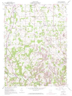
Elkton Topo Map Ohio
To zoom in, hover over the map of Elkton
USGS Topo Quad 40080g6 - 1:24,000 scale
| Topo Map Name: | Elkton |
| USGS Topo Quad ID: | 40080g6 |
| Print Size: | ca. 21 1/4" wide x 27" high |
| Southeast Coordinates: | 40.75° N latitude / 80.625° W longitude |
| Map Center Coordinates: | 40.8125° N latitude / 80.6875° W longitude |
| U.S. State: | OH |
| Filename: | o40080g6.jpg |
| Download Map JPG Image: | Elkton topo map 1:24,000 scale |
| Map Type: | Topographic |
| Topo Series: | 7.5´ |
| Map Scale: | 1:24,000 |
| Source of Map Images: | United States Geological Survey (USGS) |
| Alternate Map Versions: |
Elkton OH 1960 Download PDF Buy paper map Elkton OH 1960, updated 1962 Download PDF Buy paper map Elkton OH 1994, updated 1997 Download PDF Buy paper map Elkton OH 2010 Download PDF Buy paper map Elkton OH 2013 Download PDF Buy paper map Elkton OH 2016 Download PDF Buy paper map |
1:24,000 Topo Quads surrounding Elkton
> Back to 40080e1 at 1:100,000 scale
> Back to 40080a1 at 1:250,000 scale
> Back to U.S. Topo Maps home
Elkton topo map: Gazetteer
Elkton: Airports
Bartholow Airfield elevation 385m 1263′Elkton: Dams
Lake Copeland Dam elevation 329m 1079′Mints Pine Acres Lake Dam elevation 320m 1049′
Peterson Pond Dam elevation 339m 1112′
Elkton: Populated Places
East Fairfield elevation 373m 1223′Elkton elevation 272m 892′
Middleton elevation 384m 1259′
Newhouse (historical) elevation 344m 1128′
Rogers elevation 313m 1026′
Saratoga (historical) elevation 299m 980′
Signal elevation 336m 1102′
Sunshine Mobile Home Park elevation 378m 1240′
Unionville elevation 358m 1174′
Elkton: Post Offices
East Fairfield Post Office (historical) elevation 373m 1223′Elkton Post Office elevation 274m 898′
Signal Post Office (historical) elevation 339m 1112′
Elkton: Reservoirs
Als Lake elevation 354m 1161′Lake Copeland elevation 329m 1079′
Mints Pine Acres Lake elevation 320m 1049′
Peterson Pond elevation 339m 1112′
Shiveleys Lake elevation 321m 1053′
Elkton: Streams
Elk Run elevation 279m 915′Middle Run elevation 275m 902′
Elkton: Valleys
Pine Hollow elevation 289m 948′Elkton digital topo map on disk
Buy this Elkton topo map showing relief, roads, GPS coordinates and other geographical features, as a high-resolution digital map file on DVD:


