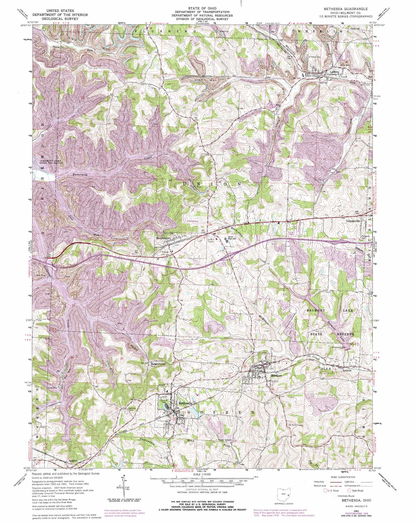
Bethesda Topo Map Ohio
To zoom in, hover over the map of Bethesda
USGS Topo Quad 40081a1 - 1:24,000 scale
| Topo Map Name: | Bethesda |
| USGS Topo Quad ID: | 40081a1 |
| Print Size: | ca. 21 1/4" wide x 27" high |
| Southeast Coordinates: | 40° N latitude / 81° W longitude |
| Map Center Coordinates: | 40.0625° N latitude / 81.0625° W longitude |
| U.S. State: | OH |
| Filename: | o40081a1.jpg |
| Download Map JPG Image: | Bethesda topo map 1:24,000 scale |
| Map Type: | Topographic |
| Topo Series: | 7.5´ |
| Map Scale: | 1:24,000 |
| Source of Map Images: | United States Geological Survey (USGS) |
| Alternate Map Versions: |
Bethesda OH 1961, updated 1962 Download PDF Buy paper map Bethesda OH 1961, updated 1973 Download PDF Buy paper map Bethesda OH 1961, updated 1978 Download PDF Buy paper map Bethesda OH 2010 Download PDF Buy paper map Bethesda OH 2013 Download PDF Buy paper map Bethesda OH 2016 Download PDF Buy paper map |
1:24,000 Topo Quads surrounding Bethesda
Tippecanoe |
Deersville |
Jewett |
Cadiz |
Smithfield |
Freeport |
Piedmont |
Flushing |
Harrisville |
Dillonvale |
Antrim |
Fairview |
Bethesda |
St Clairsville |
Lansing |
Quaker City |
Barnesville |
Hunter |
Armstrongs Mills |
Businessburg |
Summerfield |
Lewisville |
Woodsfield |
Cameron |
Powhatan Point |
> Back to 40081a1 at 1:100,000 scale
> Back to 40080a1 at 1:250,000 scale
> Back to U.S. Topo Maps home
Bethesda topo map: Gazetteer
Bethesda: Crossings
Interchange 204 elevation 291m 954′Interchange 208 elevation 360m 1181′
Bethesda: Dams
Belmont Lake Dam elevation 333m 1092′Bethesda Reservoir Dam elevation 363m 1190′
Bethesda: Parks
Belmont Historic District elevation 365m 1197′Belmont Lake State Reserve elevation 349m 1145′
Epworth Park elevation 373m 1223′
Morristown Historic District elevation 388m 1272′
Bethesda: Populated Places
Badgertown elevation 321m 1053′Belmont elevation 363m 1190′
Bethesda elevation 372m 1220′
Lafferty elevation 321m 1053′
Loomis elevation 317m 1040′
Morristown elevation 386m 1266′
Speidel elevation 390m 1279′
Bethesda: Post Offices
Belmont Post Office elevation 364m 1194′Bethesda Post Office elevation 371m 1217′
Lafferty Post Office elevation 319m 1046′
Morristown Post Office elevation 387m 1269′
Speidel Post Office (historical) elevation 389m 1276′
Bethesda: Reservoirs
Belmont Lake elevation 333m 1092′Bethesda Reservoir elevation 363m 1190′
Bethesda: Streams
Barkcamp Creek elevation 317m 1040′Coal Run elevation 277m 908′
Bethesda digital topo map on disk
Buy this Bethesda topo map showing relief, roads, GPS coordinates and other geographical features, as a high-resolution digital map file on DVD:
 map DVD")