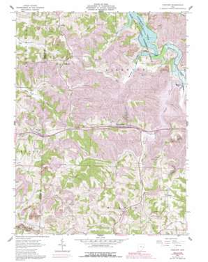
Fairview Topo Map Ohio
To zoom in, hover over the map of Fairview
USGS Topo Quad 40081a2 - 1:24,000 scale
| Topo Map Name: | Fairview |
| USGS Topo Quad ID: | 40081a2 |
| Print Size: | ca. 21 1/4" wide x 27" high |
| Southeast Coordinates: | 40° N latitude / 81.125° W longitude |
| Map Center Coordinates: | 40.0625° N latitude / 81.1875° W longitude |
| U.S. State: | OH |
| Filename: | o40081a2.jpg |
| Download Map JPG Image: | Fairview topo map 1:24,000 scale |
| Map Type: | Topographic |
| Topo Series: | 7.5´ |
| Map Scale: | 1:24,000 |
| Source of Map Images: | United States Geological Survey (USGS) |
| Alternate Map Versions: |
Fairview OH 1961, updated 1962 Download PDF Buy paper map Fairview OH 1961, updated 1978 Download PDF Buy paper map Fairview OH 1961, updated 1992 Download PDF Buy paper map Fairview OH 1994, updated 1998 Download PDF Buy paper map Fairview OH 2010 Download PDF Buy paper map Fairview OH 2013 Download PDF Buy paper map Fairview OH 2016 Download PDF Buy paper map |
1:24,000 Topo Quads surrounding Fairview
> Back to 40081a1 at 1:100,000 scale
> Back to 40080a1 at 1:250,000 scale
> Back to U.S. Topo Maps home
Fairview topo map: Gazetteer
Fairview: Airports
Barnesville-Bradfield Airport elevation 389m 1276′Fairview: Crossings
Interchange 198 elevation 365m 1197′Interchange 202 elevation 297m 974′
Fairview: Dams
Consolidation Coal Company Pond 0010-016 Dam elevation 347m 1138′State Route 800 Dam elevation 293m 961′
Fairview: Populated Places
Cabinet elevation 378m 1240′Egypt elevation 284m 931′
Fairview elevation 374m 1227′
Hendrysburg elevation 308m 1010′
Olivett elevation 383m 1256′
Sewellsville elevation 402m 1318′
Fairview: Post Offices
Cabinet Post Office (historical) elevation 370m 1213′Egypt Post Office (historical) elevation 282m 925′
Hendrysburg Post Office elevation 309m 1013′
Olivett Post Office elevation 380m 1246′
Sewellsville Post Office (historical) elevation 402m 1318′
Fairview: Reservoirs
Consolidation Coal Company Pond 0010- elevation 347m 1138′State Route 800 Reservoir elevation 293m 961′
Fairview: Streams
Buttermilk Creek elevation 283m 928′Lick Run elevation 277m 908′
Robinson Run elevation 287m 941′
Spencer Creek elevation 280m 918′
Fairview: Valleys
Sixteen Valley elevation 272m 892′Fairview digital topo map on disk
Buy this Fairview topo map showing relief, roads, GPS coordinates and other geographical features, as a high-resolution digital map file on DVD:


