Plainfield Topo Map Ohio
To zoom in, hover over the map of Plainfield
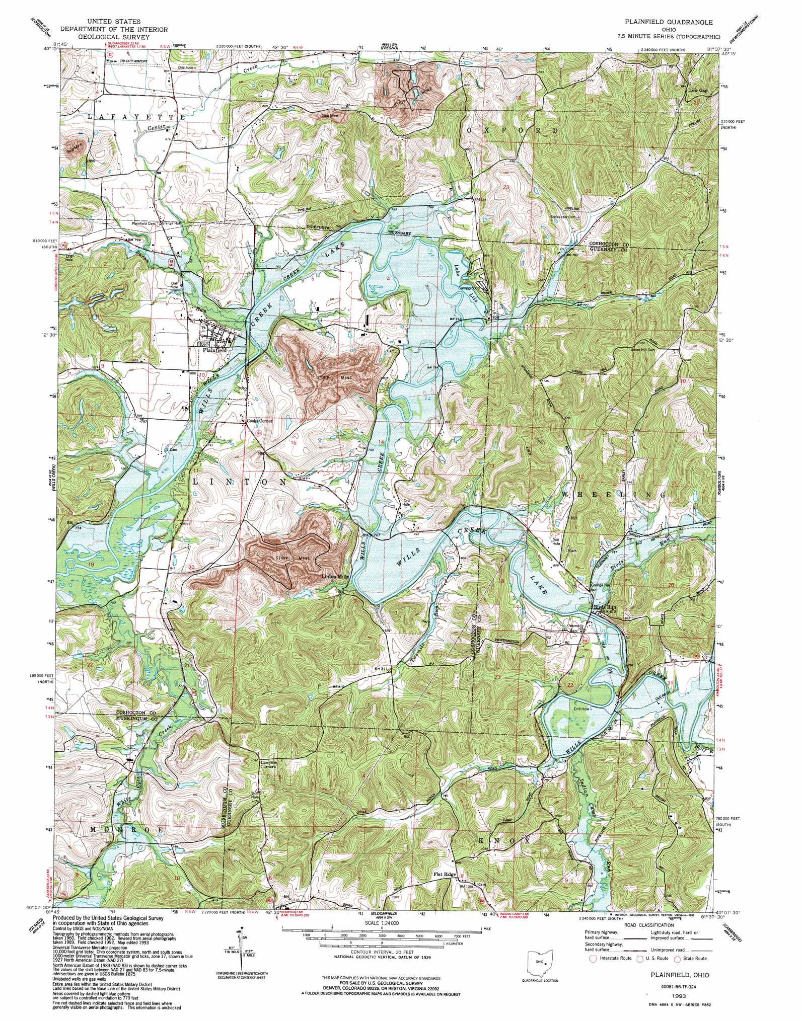
USGS Topo Quad 40081b6 - 1:24,000 scale
| Topo Map Name: | Plainfield |
| USGS Topo Quad ID: | 40081b6 |
| Print Size: | ca. 21 1/4" wide x 27" high |
| Southeast Coordinates: | 40.125° N latitude / 81.625° W longitude |
| Map Center Coordinates: | 40.1875° N latitude / 81.6875° W longitude |
| U.S. State: | OH |
| Filename: | o40081b6.jpg |
| Download Map JPG Image: | Plainfield topo map 1:24,000 scale |
| Map Type: | Topographic |
| Topo Series: | 7.5´ |
| Map Scale: | 1:24,000 |
| Source of Map Images: | United States Geological Survey (USGS) |
| Alternate Map Versions: |
Plainfield OH 1962, updated 1963 Download PDF Buy paper map Plainfield OH 1962, updated 1976 Download PDF Buy paper map Plainfield OH 1962, updated 1978 Download PDF Buy paper map Plainfield OH 1962, updated 1984 Download PDF Buy paper map Plainfield OH 1993, updated 1993 Download PDF Buy paper map Plainfield OH 1994, updated 1998 Download PDF Buy paper map Plainfield OH 2010 Download PDF Buy paper map Plainfield OH 2013 Download PDF Buy paper map Plainfield OH 2016 Download PDF Buy paper map |
1:24,000 Topo Quads surrounding Plainfield
Killbuck |
New Bedford |
Baltic |
Stone Creek |
New Philadelphia |
Randle |
Coshocton |
Fresno |
Newcomerstown |
Gnadenhutten |
Conesville |
Wills Creek |
Plainfield |
Kimbolton |
Birmingham |
Adamsville |
Otsego |
Bloomfield |
Cambridge |
Old Washington |
Zanesville East |
Norwich |
New Concord |
Byesville |
Senecaville |
> Back to 40081a1 at 1:100,000 scale
> Back to 40080a1 at 1:250,000 scale
> Back to U.S. Topo Maps home
Plainfield topo map: Gazetteer
Plainfield: Airports
Tri-City Airport elevation 249m 816′Plainfield: Dams
Darrow Lake Dam elevation 301m 987′Darrow Pond Dam elevation 301m 987′
Peabody Coal Company Pond 0115-011 Dam elevation 241m 790′
Plainfield: Populated Places
Birds Run elevation 240m 787′Flat Ridge elevation 323m 1059′
Linton Mills elevation 232m 761′
Low Gap elevation 295m 967′
Plainfield elevation 243m 797′
Stringtown (historical) elevation 247m 810′
Toledoville (historical) elevation 237m 777′
Plainfield: Post Offices
Birds Run Post Office (historical) elevation 230m 754′Flat Ridge Post Office (historical) elevation 324m 1062′
Linton Mills Post Office (historical) elevation 231m 757′
Plainfield Post Office elevation 242m 793′
Plainfield: Reservoirs
Darrow Lake elevation 301m 987′Darrow Pond elevation 301m 987′
Lake Lila elevation 229m 751′
Peabody Coal Company Pond 0115-011 elevation 241m 790′
Plainfield: Streams
Bacon Run elevation 226m 741′Birds Run elevation 231m 757′
Center Creek elevation 231m 757′
Indian Camp Run elevation 235m 770′
Twomile Run elevation 231m 757′
White Eyes Creek elevation 224m 734′
Wolf Run elevation 231m 757′
Plainfield: Summits
Roahrig Hill elevation 275m 902′Plainfield digital topo map on disk
Buy this Plainfield topo map showing relief, roads, GPS coordinates and other geographical features, as a high-resolution digital map file on DVD:
 map DVD")