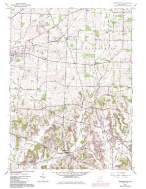
Robertsville Topo Map Ohio
To zoom in, hover over the map of Robertsville
USGS Topo Quad 40081g2 - 1:24,000 scale
| Topo Map Name: | Robertsville |
| USGS Topo Quad ID: | 40081g2 |
| Print Size: | ca. 21 1/4" wide x 27" high |
| Southeast Coordinates: | 40.75° N latitude / 81.125° W longitude |
| Map Center Coordinates: | 40.8125° N latitude / 81.1875° W longitude |
| U.S. State: | OH |
| Filename: | o40081g2.jpg |
| Download Map JPG Image: | Robertsville topo map 1:24,000 scale |
| Map Type: | Topographic |
| Topo Series: | 7.5´ |
| Map Scale: | 1:24,000 |
| Source of Map Images: | United States Geological Survey (USGS) |
| Alternate Map Versions: |
Robertsville OH 1960, updated 1961 Download PDF Buy paper map Robertsville OH 1960, updated 1966 Download PDF Buy paper map Robertsville OH 1960, updated 1972 Download PDF Buy paper map Robertsville OH 1960, updated 1985 Download PDF Buy paper map Robertsville OH 1994, updated 1998 Download PDF Buy paper map Robertsville OH 2010 Download PDF Buy paper map Robertsville OH 2013 Download PDF Buy paper map Robertsville OH 2016 Download PDF Buy paper map |
1:24,000 Topo Quads surrounding Robertsville
> Back to 40081e1 at 1:100,000 scale
> Back to 40080a1 at 1:250,000 scale
> Back to U.S. Topo Maps home
Robertsville topo map: Gazetteer
Robertsville: Airports
Yoder Airport elevation 356m 1167′Robertsville: Dams
Maple Leaf Lake Dam elevation 332m 1089′Robertsville: Lakes
Copes Lake elevation 357m 1171′Robertsville: Parks
Hidden Valley Lake Park elevation 354m 1161′Robertsville: Populated Places
Belfort elevation 340m 1115′Freeburg elevation 393m 1289′
Myers elevation 334m 1095′
Paris elevation 384m 1259′
Pleasant Valley (historical) elevation 339m 1112′
Robertsville elevation 332m 1089′
Robertsville: Post Offices
Freeburg Post Office (historical) elevation 392m 1286′Paris Post Office elevation 384m 1259′
Robertsville Post Office elevation 331m 1085′
Robertsville: Reservoirs
Hidden Valley Lake elevation 347m 1138′Maple Leaf Lake elevation 332m 1089′
Robertsville digital topo map on disk
Buy this Robertsville topo map showing relief, roads, GPS coordinates and other geographical features, as a high-resolution digital map file on DVD:


