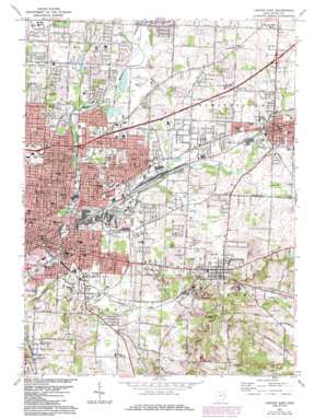
Canton East Topo Map Ohio
To zoom in, hover over the map of Canton East
USGS Topo Quad 40081g3 - 1:24,000 scale
| Topo Map Name: | Canton East |
| USGS Topo Quad ID: | 40081g3 |
| Print Size: | ca. 21 1/4" wide x 27" high |
| Southeast Coordinates: | 40.75° N latitude / 81.25° W longitude |
| Map Center Coordinates: | 40.8125° N latitude / 81.3125° W longitude |
| U.S. State: | OH |
| Filename: | o40081g3.jpg |
| Download Map JPG Image: | Canton East topo map 1:24,000 scale |
| Map Type: | Topographic |
| Topo Series: | 7.5´ |
| Map Scale: | 1:24,000 |
| Source of Map Images: | United States Geological Survey (USGS) |
| Alternate Map Versions: |
Canton East OH 1958, updated 1960 Download PDF Buy paper map Canton East OH 1967, updated 1970 Download PDF Buy paper map Canton East OH 1967, updated 1978 Download PDF Buy paper map Canton East OH 1967, updated 1985 Download PDF Buy paper map Canton East OH 1994, updated 2000 Download PDF Buy paper map Canton East OH 2010 Download PDF Buy paper map Canton East OH 2013 Download PDF Buy paper map Canton East OH 2016 Download PDF Buy paper map |
1:24,000 Topo Quads surrounding Canton East
> Back to 40081e1 at 1:100,000 scale
> Back to 40080a1 at 1:250,000 scale
> Back to U.S. Topo Maps home
Canton East topo map: Gazetteer
Canton East: Airports
Martin Field (historical) elevation 329m 1079′Stark County Sheriff Heliport elevation 345m 1131′
Canton East: Bridges
Third Street Bridge elevation 314m 1030′Canton East: Dams
Varian Lake Dam elevation 352m 1154′Canton East: Lakes
Valley Lake elevation 344m 1128′Canton East: Parks
Board Street Park elevation 348m 1141′Bors Field elevation 320m 1049′
Constitution Park elevation 338m 1108′
Cook Park elevation 317m 1040′
Grenshaw Park elevation 315m 1033′
Harmont Park elevation 344m 1128′
Harvard Park elevation 341m 1118′
Herbruck Park elevation 322m 1056′
Ida Park elevation 311m 1020′
Jackson Park elevation 314m 1030′
Maple Park elevation 319m 1046′
Martindale Park elevation 320m 1049′
Memorial Park elevation 347m 1138′
Metzger Park elevation 348m 1141′
Nimisilla Park elevation 318m 1043′
Oak Park elevation 338m 1108′
Rearick Park elevation 344m 1128′
Reifsnyder Park elevation 319m 1046′
Ridgewood Historic District elevation 340m 1115′
Riverside Park elevation 316m 1036′
Shanafelt Field elevation 326m 1069′
Upper Downtown Canton Historic District elevation 323m 1059′
Wildwood Park elevation 338m 1108′
Willig Park elevation 323m 1059′
Wilson Park elevation 337m 1105′
Canton East: Populated Places
Anchor Mobile Home Park elevation 330m 1082′Clear View Heights elevation 341m 1118′
Crystal Park elevation 322m 1056′
East Canton elevation 355m 1164′
East Orchard elevation 330m 1082′
Fairhope elevation 332m 1089′
Louisville elevation 348m 1141′
Louisville Mobile Park elevation 335m 1099′
Lynn Center Park elevation 349m 1145′
Marks (historical) elevation 330m 1082′
Moreland elevation 329m 1079′
Orchard Heights elevation 337m 1105′
Plain elevation 338m 1108′
Pleasant View elevation 325m 1066′
Pleasant View Village elevation 324m 1062′
Richmond Mobile Home Park elevation 339m 1112′
Shady Knoll Mobile Park elevation 341m 1118′
Thunderbird Terrace elevation 336m 1102′
Trump elevation 323m 1059′
Waco elevation 326m 1069′
Willow Brook Heights elevation 331m 1085′
Canton East: Post Offices
East Canton Post Office (historical) elevation 354m 1161′Fairhope Post Office (historical) elevation 333m 1092′
Louisville Post Office elevation 347m 1138′
Louisville Post Office elevation 348m 1141′
Trump Post Office (historical) elevation 323m 1059′
Waco Post Office (historical) elevation 326m 1069′
Canton East: Reservoirs
Varian Lake elevation 352m 1154′Canton East: Streams
East Branch Nimishillen Creek elevation 317m 1040′Middle Branch Nimishillen Creek elevation 317m 1040′
Canton East digital topo map on disk
Buy this Canton East topo map showing relief, roads, GPS coordinates and other geographical features, as a high-resolution digital map file on DVD:


