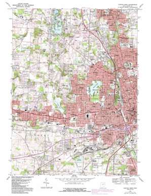
Canton West Topo Map Ohio
To zoom in, hover over the map of Canton West
USGS Topo Quad 40081g4 - 1:24,000 scale
| Topo Map Name: | Canton West |
| USGS Topo Quad ID: | 40081g4 |
| Print Size: | ca. 21 1/4" wide x 27" high |
| Southeast Coordinates: | 40.75° N latitude / 81.375° W longitude |
| Map Center Coordinates: | 40.8125° N latitude / 81.4375° W longitude |
| U.S. State: | OH |
| Filename: | o40081g4.jpg |
| Download Map JPG Image: | Canton West topo map 1:24,000 scale |
| Map Type: | Topographic |
| Topo Series: | 7.5´ |
| Map Scale: | 1:24,000 |
| Source of Map Images: | United States Geological Survey (USGS) |
| Alternate Map Versions: |
Canton West OH 1958, updated 1960 Download PDF Buy paper map Canton West OH 1967, updated 1969 Download PDF Buy paper map Canton West OH 1967, updated 1978 Download PDF Buy paper map Canton West OH 1967, updated 1985 Download PDF Buy paper map Canton West OH 1994, updated 2000 Download PDF Buy paper map Canton West OH 2010 Download PDF Buy paper map Canton West OH 2013 Download PDF Buy paper map Canton West OH 2016 Download PDF Buy paper map |
1:24,000 Topo Quads surrounding Canton West
> Back to 40081e1 at 1:100,000 scale
> Back to 40080a1 at 1:250,000 scale
> Back to U.S. Topo Maps home
Canton West topo map: Gazetteer
Canton West: Airports
Cross Airport elevation 340m 1115′Lockeridge Airport elevation 328m 1076′
Timken Mercy Medical Center Heliport elevation 340m 1115′
Canton West: Crossings
Interchange 103 elevation 311m 1020′Interchange 104 elevation 310m 1017′
Interchange 105 elevation 317m 1040′
Interchange 106 elevation 338m 1108′
Interchange 107 elevation 333m 1092′
Interchange 109 elevation 331m 1085′
Canton West: Dams
Lake Cable Dam elevation 334m 1095′Lake O'Springs Dam elevation 338m 1108′
Timken Lake Dam elevation 315m 1033′
Canton West: Lakes
Meyers Lake elevation 337m 1105′Canton West: Parks
Arboretum Park elevation 317m 1040′Avondale Arboretum elevation 317m 1040′
Bauhoff Park elevation 305m 1000′
City Field Park elevation 308m 1010′
Covered Bridge Park elevation 324m 1062′
Cradle Park elevation 336m 1102′
Devonshire Park elevation 325m 1066′
Don Scott Field elevation 341m 1118′
Faircrest Park elevation 316m 1036′
Fawcett Stadium elevation 339m 1112′
First Ladies National Historic Site elevation 323m 1059′
Freeway Park elevation 306m 1003′
Garaux Park elevation 337m 1105′
Glenhurst Park elevation 327m 1072′
Grove Miller Park elevation 329m 1079′
Jackson Community Park elevation 325m 1066′
Jeaneret Park elevation 334m 1095′
Lake O'Springs Park elevation 336m 1102′
Lawrence Playground elevation 334m 1095′
Maryland Park elevation 330m 1082′
McKinley Memorial Park elevation 314m 1030′
McKinley Monument elevation 334m 1095′
McKinley Park elevation 321m 1053′
Myers Park elevation 330m 1082′
Paul Brown Tiger Stadium Park elevation 316m 1036′
Robert W Starcher Baseball Field elevation 356m 1167′
Sippo Lake Regional Park elevation 314m 1030′
Spiker Park elevation 326m 1069′
Tiger Stadium Park elevation 318m 1043′
Timken County Park elevation 338m 1108′
Wales Park elevation 307m 1007′
Water Works Park elevation 310m 1017′
West Park elevation 309m 1013′
West Park elevation 316m 1036′
Westbrook Park elevation 333m 1092′
Witwell Park elevation 351m 1151′
Canton West: Populated Places
Avondale elevation 346m 1135′Banker Heights elevation 332m 1089′
Belvidere elevation 339m 1112′
Canton elevation 323m 1059′
Canton Gardens elevation 330m 1082′
Deluxe Mobile Home Park elevation 315m 1033′
Edgefield elevation 356m 1167′
Edgewood Park elevation 327m 1072′
Edmeyer Park elevation 344m 1128′
Fulton Heights elevation 351m 1151′
Gambrinus elevation 326m 1069′
Genoa elevation 346m 1135′
Grove Mill elevation 341m 1118′
Harter Heights elevation 338m 1108′
Hills and Dales elevation 341m 1118′
Indianola Estates elevation 344m 1128′
Industrial Heights elevation 311m 1020′
Ingold Heights elevation 333m 1092′
Lake Cable elevation 341m 1118′
Lake View Heights elevation 351m 1151′
Lakeside Heights elevation 347m 1138′
Lakeview Heights elevation 343m 1125′
Lakeview Terrace elevation 336m 1102′
Lincoln Heights elevation 334m 1095′
Melody Mobile Home Park elevation 330m 1082′
Meyers Lake elevation 338m 1108′
Monterey Heights elevation 332m 1089′
Mount Marie Heights elevation 331m 1085′
Mount Vernon elevation 356m 1167′
Oak Manor elevation 333m 1092′
Orchard Acres elevation 336m 1102′
Parkridge elevation 344m 1128′
Perry Heights elevation 335m 1099′
Reedurban elevation 331m 1085′
Richville elevation 323m 1059′
Ridgedale elevation 335m 1099′
Skyline Hills elevation 341m 1118′
South Haven Mobile Park elevation 308m 1010′
Sun Valley Mobile Home Park elevation 319m 1046′
Sunny Acres Mobile Park elevation 344m 1128′
Sweetbriar elevation 332m 1089′
Terrace Mobile Park elevation 337m 1105′
The Knolls elevation 331m 1085′
Trailer City elevation 340m 1115′
West Manor elevation 331m 1085′
West Manor Mobile Home Park elevation 332m 1089′
Westland Park elevation 331m 1085′
Westview elevation 343m 1125′
Whipple Heights elevation 341m 1118′
Whispering Oaks elevation 319m 1046′
Whittier Park elevation 315m 1033′
Canton West: Post Offices
Canton Post Office elevation 323m 1059′Canton Post Office elevation 323m 1059′
Reedurban Post Office (historical) elevation 330m 1082′
Richville Post Office (historical) elevation 323m 1059′
Canton West: Reservoirs
Lake Cable elevation 334m 1095′Lake O'Springs elevation 338m 1108′
Sippo Lake elevation 312m 1023′
Spring Valley Lake elevation 324m 1062′
Timken Lake elevation 315m 1033′
Canton West: Streams
Hurford Run elevation 306m 1003′Sherrick Run elevation 304m 997′
West Branch Nimishillen Creek elevation 308m 1010′
Canton West digital topo map on disk
Buy this Canton West topo map showing relief, roads, GPS coordinates and other geographical features, as a high-resolution digital map file on DVD:


