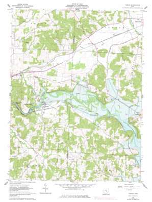
Toboso Topo Map Ohio
To zoom in, hover over the map of Toboso
USGS Topo Quad 40082a2 - 1:24,000 scale
| Topo Map Name: | Toboso |
| USGS Topo Quad ID: | 40082a2 |
| Print Size: | ca. 21 1/4" wide x 27" high |
| Southeast Coordinates: | 40° N latitude / 82.125° W longitude |
| Map Center Coordinates: | 40.0625° N latitude / 82.1875° W longitude |
| U.S. State: | OH |
| Filename: | o40082a2.jpg |
| Download Map JPG Image: | Toboso topo map 1:24,000 scale |
| Map Type: | Topographic |
| Topo Series: | 7.5´ |
| Map Scale: | 1:24,000 |
| Source of Map Images: | United States Geological Survey (USGS) |
| Alternate Map Versions: |
Toboso OH 1962, updated 1963 Download PDF Buy paper map Toboso OH 1962, updated 1974 Download PDF Buy paper map Toboso OH 1962, updated 1978 Download PDF Buy paper map Toboso OH 1962, updated 1978 Download PDF Buy paper map Toboso OH 2010 Download PDF Buy paper map Toboso OH 2013 Download PDF Buy paper map Toboso OH 2016 Download PDF Buy paper map |
1:24,000 Topo Quads surrounding Toboso
> Back to 40082a1 at 1:100,000 scale
> Back to 40082a1 at 1:250,000 scale
> Back to U.S. Topo Maps home
Toboso topo map: Gazetteer
Toboso: Airports
Massengill Airport elevation 300m 984′Varner Airport elevation 283m 928′
Vensil Farms Airport elevation 231m 757′
Toboso: Dams
Nashport Dike elevation 244m 800′Toboso: Gaps
Black Hand Narrows elevation 230m 754′Toboso: Islands
Black Hand Rock elevation 244m 800′Toboso: Parks
Black Hand State Nature Preserve elevation 313m 1026′Dillon Reservoir Wildlife Area elevation 231m 757′
Dillon State Park elevation 280m 918′
Toboso: Populated Places
Black Run elevation 237m 777′Boston elevation 274m 898′
Claypools (historical) elevation 263m 862′
Cottage Hill elevation 278m 912′
Irville elevation 251m 823′
Nashport elevation 252m 826′
Pleasant Valley (historical) elevation 222m 728′
Rock Haven Park elevation 257m 843′
Toboso elevation 238m 780′
Toboso: Post Offices
Cottagehill Post Office (historical) elevation 268m 879′Irville Post Office (historical) elevation 243m 797′
Nashport Post Office elevation 248m 813′
Pleasant Valley Post Office (historical) elevation 220m 721′
Toboso Post Office (historical) elevation 237m 777′
Toboso: Streams
Bear Run elevation 249m 816′Black Run elevation 225m 738′
Stump Run elevation 228m 748′
Toboso: Summits
Bald Knob elevation 337m 1105′Toboso: Valleys
Bear Hollow elevation 250m 820′Licking Gorge elevation 229m 751′
Toboso digital topo map on disk
Buy this Toboso topo map showing relief, roads, GPS coordinates and other geographical features, as a high-resolution digital map file on DVD:


