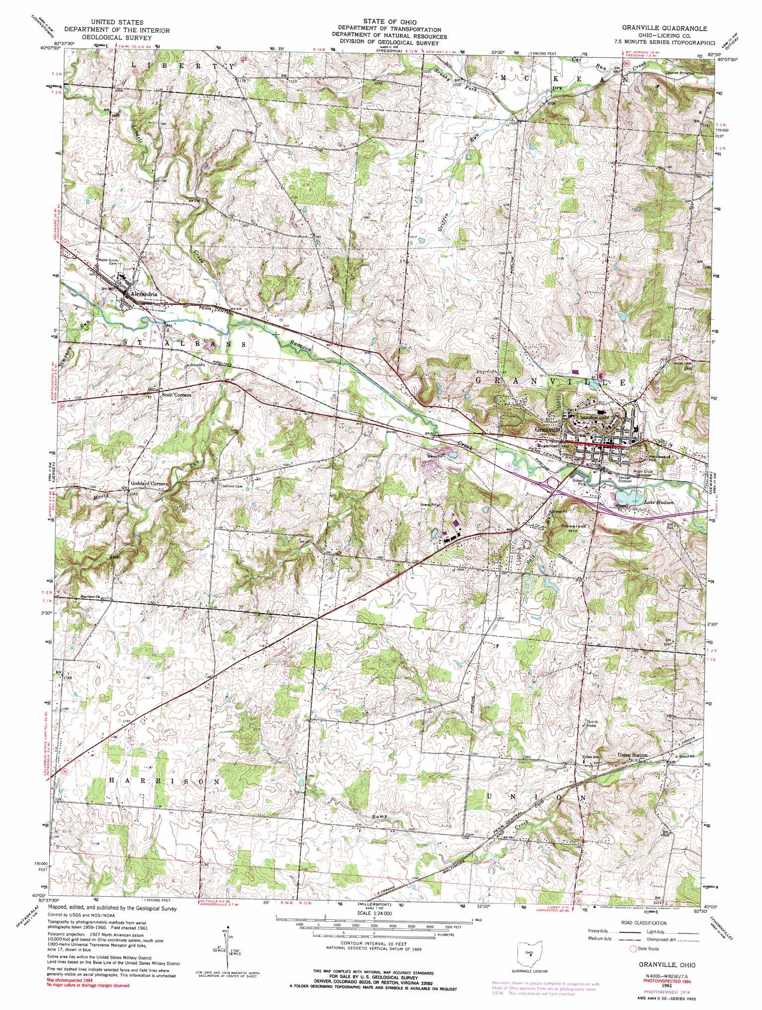
Granville Topo Map Ohio
To zoom in, hover over the map of Granville
USGS Topo Quad 40082a5 - 1:24,000 scale
| Topo Map Name: | Granville |
| USGS Topo Quad ID: | 40082a5 |
| Print Size: | ca. 21 1/4" wide x 27" high |
| Southeast Coordinates: | 40° N latitude / 82.5° W longitude |
| Map Center Coordinates: | 40.0625° N latitude / 82.5625° W longitude |
| U.S. State: | OH |
| Filename: | o40082a5.jpg |
| Download Map JPG Image: | Granville topo map 1:24,000 scale |
| Map Type: | Topographic |
| Topo Series: | 7.5´ |
| Map Scale: | 1:24,000 |
| Source of Map Images: | United States Geological Survey (USGS) |
| Alternate Map Versions: |
Granville OH 1961, updated 1962 Download PDF Buy paper map Granville OH 1961, updated 1972 Download PDF Buy paper map Granville OH 1961, updated 1975 Download PDF Buy paper map Granville OH 2010 Download PDF Buy paper map Granville OH 2013 Download PDF Buy paper map Granville OH 2016 Download PDF Buy paper map |
1:24,000 Topo Quads surrounding Granville
Olive Green |
Centerburg |
Homer |
Hunt |
Martinsburg |
Sunbury |
Johnstown |
Fredonia |
Utica |
Hickman |
New Albany |
Jersey |
Granville |
Newark |
Hanover |
Reynoldsburg |
Pataskala |
Millersport |
Thornville |
Glenford |
Canal Winchester |
Carroll |
Baltimore |
Rushville |
Somerset |
> Back to 40082a1 at 1:100,000 scale
> Back to 40082a1 at 1:250,000 scale
> Back to U.S. Topo Maps home
Granville topo map: Gazetteer
Granville: Bridges
McLains Bridge elevation 286m 938′Granville: Dams
Postelwaite Lake Dam elevation 334m 1095′Granville: Lakes
Lake Hudson elevation 274m 898′Granville: Parks
Deeds Field elevation 304m 997′Granville Historic District elevation 293m 961′
Piper Stadium elevation 305m 1000′
Granville: Populated Places
Alexandria elevation 296m 971′Goddard Corners elevation 329m 1079′
Granville elevation 293m 961′
Scott Corners elevation 304m 997′
Union Station elevation 288m 944′
Granville: Post Offices
Alexandria Post Office elevation 298m 977′Granville Post Office elevation 293m 961′
Union Station Post Office (historical) elevation 285m 935′
Granville: Streams
Brushy Fork elevation 302m 990′Cat Run elevation 299m 980′
Griffin Run elevation 303m 994′
Lobdell Creek elevation 283m 928′
Moots Run elevation 283m 928′
Salt Run elevation 274m 898′
Simpson Run elevation 288m 944′
Granville: Summits
Flowerpot Hill elevation 334m 1095′Parnassus Hill elevation 325m 1066′
Sugarloaf Hill elevation 321m 1053′
Granville digital topo map on disk
Buy this Granville topo map showing relief, roads, GPS coordinates and other geographical features, as a high-resolution digital map file on DVD:
 map DVD")