Jersey Topo Map Ohio
To zoom in, hover over the map of Jersey
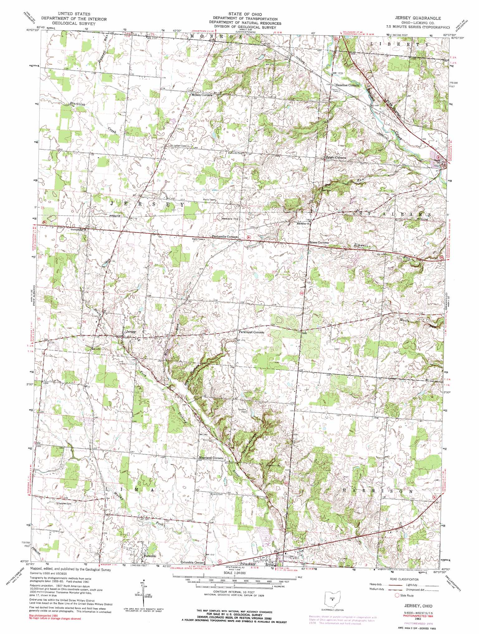
USGS Topo Quad 40082a6 - 1:24,000 scale
| Topo Map Name: | Jersey |
| USGS Topo Quad ID: | 40082a6 |
| Print Size: | ca. 21 1/4" wide x 27" high |
| Southeast Coordinates: | 40° N latitude / 82.625° W longitude |
| Map Center Coordinates: | 40.0625° N latitude / 82.6875° W longitude |
| U.S. State: | OH |
| Filename: | o40082a6.jpg |
| Download Map JPG Image: | Jersey topo map 1:24,000 scale |
| Map Type: | Topographic |
| Topo Series: | 7.5´ |
| Map Scale: | 1:24,000 |
| Source of Map Images: | United States Geological Survey (USGS) |
| Alternate Map Versions: |
Jersey OH 1961, updated 1962 Download PDF Buy paper map Jersey OH 1961, updated 1975 Download PDF Buy paper map Jersey OH 1961, updated 1984 Download PDF Buy paper map Jersey OH 2010 Download PDF Buy paper map Jersey OH 2013 Download PDF Buy paper map Jersey OH 2016 Download PDF Buy paper map |
1:24,000 Topo Quads surrounding Jersey
Kilbourne |
Olive Green |
Centerburg |
Homer |
Hunt |
Galena |
Sunbury |
Johnstown |
Fredonia |
Utica |
Northeast Columbus |
New Albany |
Jersey |
Granville |
Newark |
Southeast Columbus |
Reynoldsburg |
Pataskala |
Millersport |
Thornville |
Lockbourne |
Canal Winchester |
Carroll |
Baltimore |
Rushville |
> Back to 40082a1 at 1:100,000 scale
> Back to 40082a1 at 1:250,000 scale
> Back to U.S. Topo Maps home
Jersey topo map: Gazetteer
Jersey: Airports
Kearns Airport elevation 367m 1204′Remington Heliport elevation 350m 1148′
Jersey: Dams
Gardner Pond Dam elevation 336m 1102′Jersey: Populated Places
Ash elevation 374m 1227′Beechwood Trails elevation 368m 1207′
Fursville elevation 319m 1046′
Jersey elevation 344m 1128′
Millers Corners elevation 363m 1190′
Moreland Corners elevation 326m 1069′
Panhandle Corners elevation 368m 1207′
Tylers Corners elevation 342m 1122′
Jersey: Post Offices
Ash Post Office (historical) elevation 374m 1227′Jersey Post Office (historical) elevation 344m 1128′
Jersey: Reservoirs
Gardner Pond elevation 336m 1102′Jersey: Streams
Cornell Run elevation 306m 1003′Mile Run elevation 326m 1069′
Pet Run elevation 292m 958′
Jersey: Summits
Beavers Hill elevation 383m 1256′Jersey: Valleys
Big Hollow elevation 332m 1089′Coon Hollow elevation 325m 1066′
Jersey digital topo map on disk
Buy this Jersey topo map showing relief, roads, GPS coordinates and other geographical features, as a high-resolution digital map file on DVD:
 map DVD")