Utica Topo Map Ohio
To zoom in, hover over the map of Utica
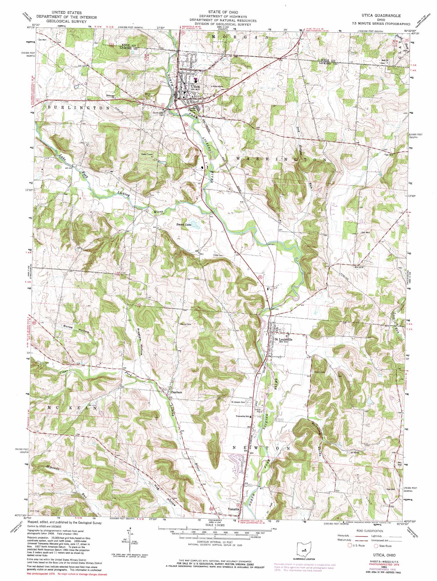
USGS Topo Quad 40082b4 - 1:24,000 scale
| Topo Map Name: | Utica |
| USGS Topo Quad ID: | 40082b4 |
| Print Size: | ca. 21 1/4" wide x 27" high |
| Southeast Coordinates: | 40.125° N latitude / 82.375° W longitude |
| Map Center Coordinates: | 40.1875° N latitude / 82.4375° W longitude |
| U.S. State: | OH |
| Filename: | o40082b4.jpg |
| Download Map JPG Image: | Utica topo map 1:24,000 scale |
| Map Type: | Topographic |
| Topo Series: | 7.5´ |
| Map Scale: | 1:24,000 |
| Source of Map Images: | United States Geological Survey (USGS) |
| Alternate Map Versions: |
Utica OH 1961, updated 1962 Download PDF Buy paper map Utica OH 1961, updated 1971 Download PDF Buy paper map Utica OH 1961, updated 1981 Download PDF Buy paper map Utica OH 2010 Download PDF Buy paper map Utica OH 2013 Download PDF Buy paper map Utica OH 2016 Download PDF Buy paper map |
1:24,000 Topo Quads surrounding Utica
Chesterville |
Fredericktown |
Mount Vernon |
Danville |
Brinkhaven |
Centerburg |
Homer |
Hunt |
Martinsburg |
Walhonding |
Johnstown |
Fredonia |
Utica |
Hickman |
Perryton |
Jersey |
Granville |
Newark |
Hanover |
Toboso |
Pataskala |
Millersport |
Thornville |
Glenford |
Gratiot |
> Back to 40082a1 at 1:100,000 scale
> Back to 40082a1 at 1:250,000 scale
> Back to U.S. Topo Maps home
Utica topo map: Gazetteer
Utica: Areas
Cranberry Prairie elevation 280m 918′Utica: Dams
Hoar Pond Dam elevation 342m 1122′Utica: Lakes
Prairie Lake (historical) elevation 314m 1030′Smoot Lake elevation 280m 918′
Utica: Populated Places
Chatham elevation 287m 941′Saint Louisville elevation 272m 892′
Utica elevation 292m 958′
Vanatta elevation 268m 879′
Utica: Post Offices
Appleton Post Office (historical) elevation 342m 1122′Saint Louisville Post Office elevation 269m 882′
Utica Post Office elevation 292m 958′
Vanatta Post Office (historical) elevation 267m 875′
Utica: Reservoirs
Hoar Pond elevation 342m 1122′Utica: Streams
Clear Fork Licking River elevation 262m 859′Dog Hollow Run elevation 277m 908′
Lake Fork Licking River elevation 280m 918′
Utica: Valleys
Burse Hollow elevation 302m 990′Hog Hollow elevation 277m 908′
Preston Hollow elevation 293m 961′
Wyoming Valley elevation 277m 908′
Utica digital topo map on disk
Buy this Utica topo map showing relief, roads, GPS coordinates and other geographical features, as a high-resolution digital map file on DVD:
 map DVD")