Spring Mountain Topo Map Ohio
To zoom in, hover over the map of Spring Mountain
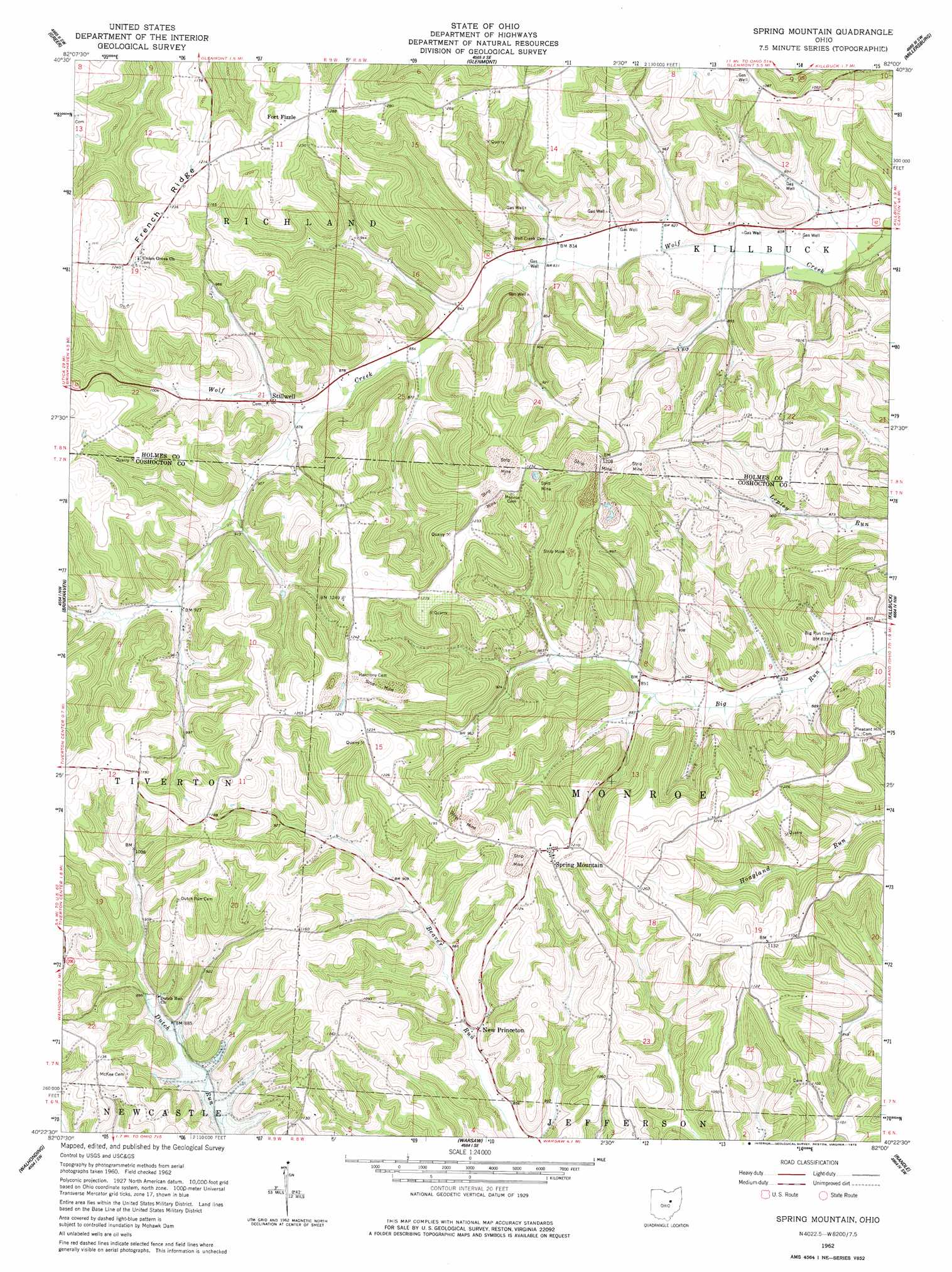
USGS Topo Quad 40082d1 - 1:24,000 scale
| Topo Map Name: | Spring Mountain |
| USGS Topo Quad ID: | 40082d1 |
| Print Size: | ca. 21 1/4" wide x 27" high |
| Southeast Coordinates: | 40.375° N latitude / 82° W longitude |
| Map Center Coordinates: | 40.4375° N latitude / 82.0625° W longitude |
| U.S. State: | OH |
| Filename: | o40082d1.jpg |
| Download Map JPG Image: | Spring Mountain topo map 1:24,000 scale |
| Map Type: | Topographic |
| Topo Series: | 7.5´ |
| Map Scale: | 1:24,000 |
| Source of Map Images: | United States Geological Survey (USGS) |
| Alternate Map Versions: |
Spring Mountain OH 1962, updated 1963 Download PDF Buy paper map Spring Mountain OH 1962, updated 1978 Download PDF Buy paper map Spring Mountain OH 2010 Download PDF Buy paper map Spring Mountain OH 2013 Download PDF Buy paper map Spring Mountain OH 2016 Download PDF Buy paper map |
1:24,000 Topo Quads surrounding Spring Mountain
Perrysville |
Loudonville |
Shreve |
Holmesville |
Fredericksburg |
Jelloway |
Greer |
Glenmont |
Millersburg |
Berlin |
Danville |
Brinkhaven |
Spring Mountain |
Killbuck |
New Bedford |
Martinsburg |
Walhonding |
Warsaw |
Randle |
Coshocton |
Hickman |
Perryton |
Trinway |
Conesville |
Wills Creek |
> Back to 40082a1 at 1:100,000 scale
> Back to 40082a1 at 1:250,000 scale
> Back to U.S. Topo Maps home
Spring Mountain topo map: Gazetteer
Spring Mountain: Populated Places
Fort Fizzle elevation 373m 1223′New Princeton elevation 266m 872′
Spring Mountain elevation 373m 1223′
Stillwell elevation 272m 892′
Spring Mountain: Post Offices
New Princeton Post Office (historical) elevation 270m 885′Spring Mountain Post Office (historical) elevation 373m 1223′
Stilwell Post Office (historical) elevation 271m 889′
Spring Mountain: Ridges
French Ridge elevation 377m 1236′Spring Mountain digital topo map on disk
Buy this Spring Mountain topo map showing relief, roads, GPS coordinates and other geographical features, as a high-resolution digital map file on DVD:
 map DVD")