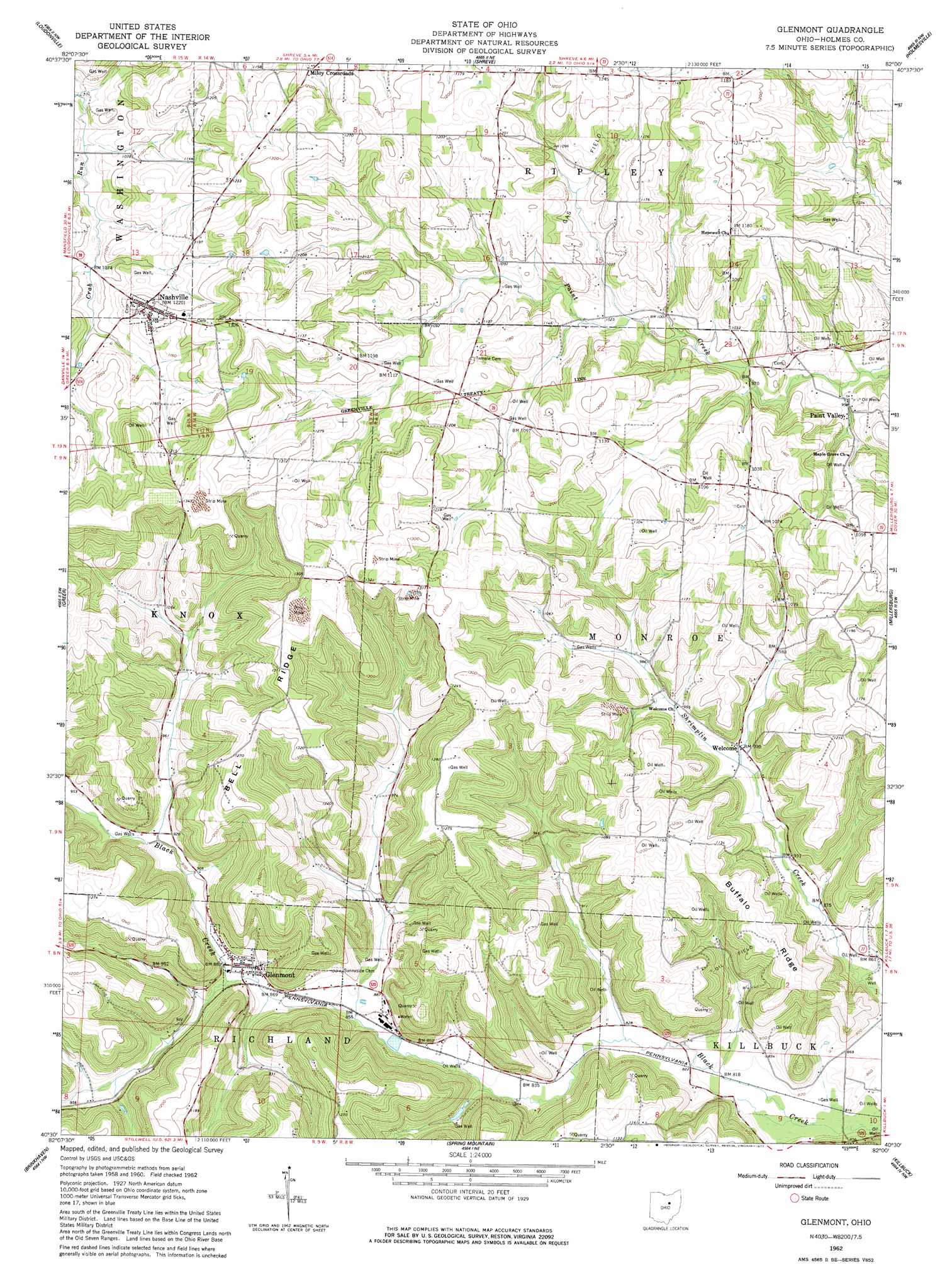
Glenmont Topo Map Ohio
To zoom in, hover over the map of Glenmont
USGS Topo Quad 40082e1 - 1:24,000 scale
| Topo Map Name: | Glenmont |
| USGS Topo Quad ID: | 40082e1 |
| Print Size: | ca. 21 1/4" wide x 27" high |
| Southeast Coordinates: | 40.5° N latitude / 82° W longitude |
| Map Center Coordinates: | 40.5625° N latitude / 82.0625° W longitude |
| U.S. State: | OH |
| Filename: | o40082e1.jpg |
| Download Map JPG Image: | Glenmont topo map 1:24,000 scale |
| Map Type: | Topographic |
| Topo Series: | 7.5´ |
| Map Scale: | 1:24,000 |
| Source of Map Images: | United States Geological Survey (USGS) |
| Alternate Map Versions: |
Glenmont OH 1962, updated 1963 Download PDF Buy paper map Glenmont OH 1962, updated 1977 Download PDF Buy paper map Glenmont OH 2010 Download PDF Buy paper map Glenmont OH 2013 Download PDF Buy paper map Glenmont OH 2016 Download PDF Buy paper map |
1:24,000 Topo Quads surrounding Glenmont
Ashland South |
Jeromesville |
New Pittsburg |
Wooster |
Orrville |
Perrysville |
Loudonville |
Shreve |
Holmesville |
Fredericksburg |
Jelloway |
Greer |
Glenmont |
Millersburg |
Berlin |
Danville |
Brinkhaven |
Spring Mountain |
Killbuck |
New Bedford |
Martinsburg |
Walhonding |
Warsaw |
Randle |
Coshocton |
> Back to 40082e1 at 1:100,000 scale
> Back to 40082a1 at 1:250,000 scale
> Back to U.S. Topo Maps home
Glenmont topo map: Gazetteer
Glenmont: Populated Places
Glenmont elevation 268m 879′Miley Crossroads elevation 352m 1154′
Nashville elevation 373m 1223′
Paint Valley elevation 292m 958′
Welcome elevation 282m 925′
Glenmont: Post Offices
Glenmont Post Office elevation 267m 875′Nashville Post Office elevation 373m 1223′
Paint Valley Post Office (historical) elevation 293m 961′
Welcome Post Office (historical) elevation 282m 925′
Glenmont: Ridges
Bell Ridge elevation 395m 1295′Buffalo Ridge elevation 346m 1135′
Glenmont digital topo map on disk
Buy this Glenmont topo map showing relief, roads, GPS coordinates and other geographical features, as a high-resolution digital map file on DVD:
 map DVD")