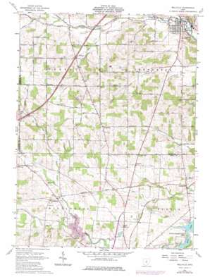
Bellville Topo Map Ohio
To zoom in, hover over the map of Bellville
USGS Topo Quad 40082e5 - 1:24,000 scale
| Topo Map Name: | Bellville |
| USGS Topo Quad ID: | 40082e5 |
| Print Size: | ca. 21 1/4" wide x 27" high |
| Southeast Coordinates: | 40.5° N latitude / 82.5° W longitude |
| Map Center Coordinates: | 40.5625° N latitude / 82.5625° W longitude |
| U.S. State: | OH |
| Filename: | o40082e5.jpg |
| Download Map JPG Image: | Bellville topo map 1:24,000 scale |
| Map Type: | Topographic |
| Topo Series: | 7.5´ |
| Map Scale: | 1:24,000 |
| Source of Map Images: | United States Geological Survey (USGS) |
| Alternate Map Versions: |
Bellville OH 1961, updated 1962 Download PDF Buy paper map Bellville OH 1961, updated 1973 Download PDF Buy paper map Bellville OH 1961, updated 1975 Download PDF Buy paper map Bellville OH 2010 Download PDF Buy paper map Bellville OH 2013 Download PDF Buy paper map Bellville OH 2016 Download PDF Buy paper map |
1:24,000 Topo Quads surrounding Bellville
> Back to 40082e1 at 1:100,000 scale
> Back to 40082a1 at 1:250,000 scale
> Back to U.S. Topo Maps home
Bellville topo map: Gazetteer
Bellville: Airports
Bender Airport elevation 347m 1138′Craft Airport elevation 332m 1089′
Bellville: Dams
North Branch of Kokosing Dam elevation 335m 1099′Timberline Camp Lake Dam elevation 397m 1302′
Bellville: Parks
Kokosing Wildlife Area elevation 339m 1112′Bellville: Populated Places
Ankenytown elevation 348m 1141′Bangorville elevation 419m 1374′
Batemantown elevation 351m 1151′
Bellville elevation 347m 1138′
Darlington elevation 408m 1338′
Palmyra elevation 366m 1200′
Waterford elevation 356m 1167′
Bellville: Post Offices
Ankenytown Post Office (historical) elevation 353m 1158′Bangor Post Office (historical) elevation 420m 1377′
Batemantown Post Office (historical) elevation 351m 1151′
Bellville Post Office elevation 348m 1141′
Darlngton Post Office (historical) elevation 409m 1341′
Bellville: Reservoirs
North Branch Kokosing River Lake elevation 335m 1099′Timberline Camp Lake elevation 397m 1302′
Bellville: Streams
Cedar Fork elevation 344m 1128′Lost Run elevation 345m 1131′
Steel Run elevation 350m 1148′
Bellville: Summits
Schweitzer Hill elevation 400m 1312′Bellville digital topo map on disk
Buy this Bellville topo map showing relief, roads, GPS coordinates and other geographical features, as a high-resolution digital map file on DVD:


