Ashland North Topo Map Ohio
To zoom in, hover over the map of Ashland North
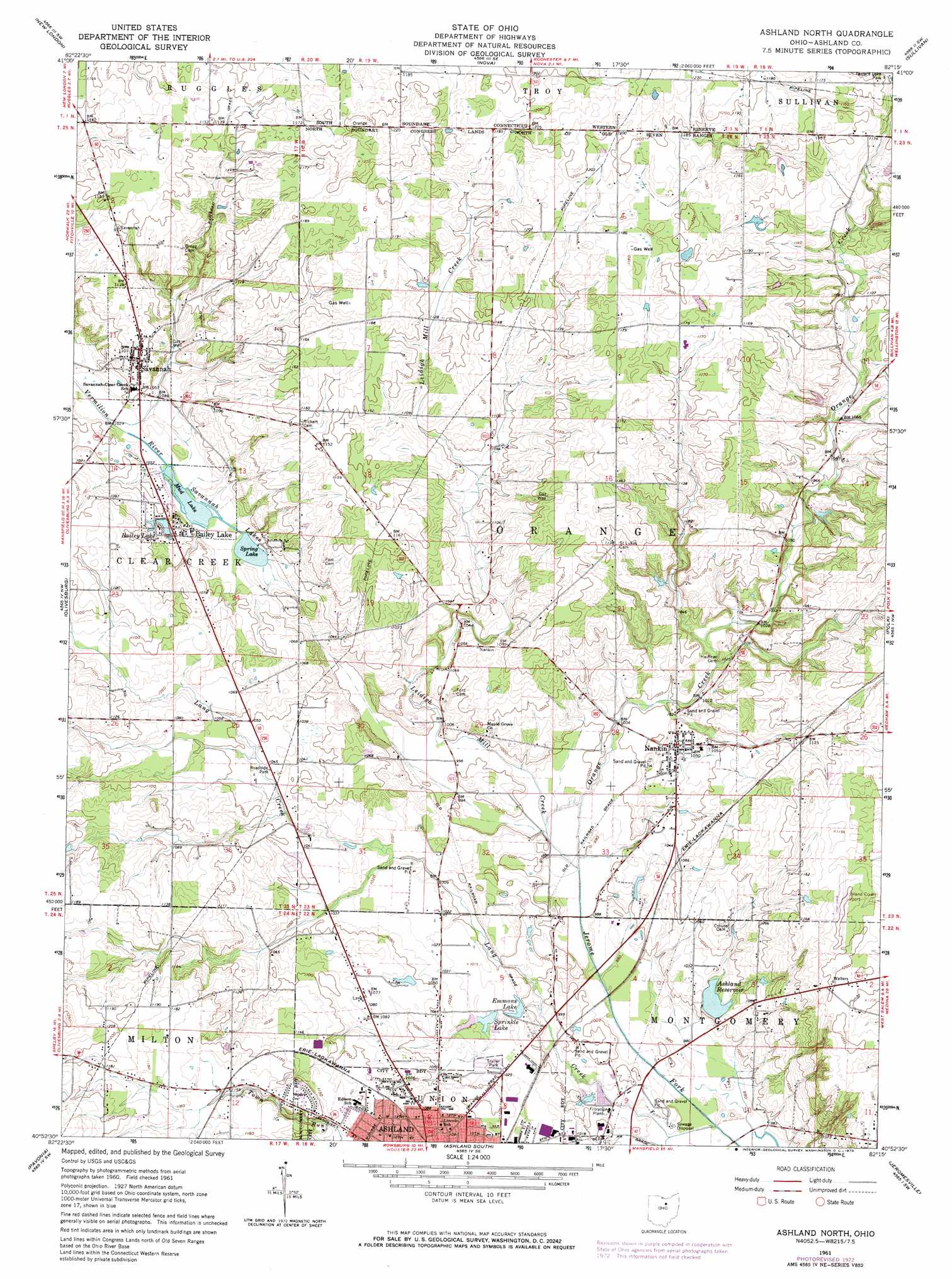
USGS Topo Quad 40082h3 - 1:24,000 scale
| Topo Map Name: | Ashland North |
| USGS Topo Quad ID: | 40082h3 |
| Print Size: | ca. 21 1/4" wide x 27" high |
| Southeast Coordinates: | 40.875° N latitude / 82.25° W longitude |
| Map Center Coordinates: | 40.9375° N latitude / 82.3125° W longitude |
| U.S. State: | OH |
| Filename: | o40082h3.jpg |
| Download Map JPG Image: | Ashland North topo map 1:24,000 scale |
| Map Type: | Topographic |
| Topo Series: | 7.5´ |
| Map Scale: | 1:24,000 |
| Source of Map Images: | United States Geological Survey (USGS) |
| Alternate Map Versions: |
Ashland North OH 1961, updated 1963 Download PDF Buy paper map Ashland North OH 1961, updated 1973 Download PDF Buy paper map Ashland North OH 1961, updated 1973 Download PDF Buy paper map Ashland North OH 2010 Download PDF Buy paper map Ashland North OH 2013 Download PDF Buy paper map Ashland North OH 2016 Download PDF Buy paper map |
1:24,000 Topo Quads surrounding Ashland North
Norwalk |
Clarksfield |
Brighton |
Wellington |
Lagrange |
Greenwich |
New London |
Nova |
Sullivan |
Lodi |
Shiloh |
Olivesburg |
Ashland North |
Polk |
West Salem |
Mansfield North |
Pavonia |
Ashland South |
Jeromesville |
New Pittsburg |
Mansfield South |
Lucas |
Perrysville |
Loudonville |
Shreve |
> Back to 40082e1 at 1:100,000 scale
> Back to 40082a1 at 1:250,000 scale
> Back to U.S. Topo Maps home
Ashland North topo map: Gazetteer
Ashland North: Airports
Ashland County Airport elevation 365m 1197′ODOT District 3 Heliport elevation 309m 1013′
Vogel Airpark elevation 312m 1023′
Ashland North: Dams
Lance Lake Dam elevation 320m 1049′Slyman Lake Dam elevation 328m 1076′
Ashland North: Lakes
Bailey Lake elevation 319m 1046′Emmons Lake elevation 306m 1003′
Mud Lake elevation 310m 1017′
Savannah Lakes elevation 309m 1013′
Spring Lake elevation 312m 1023′
Sprinkle Lake elevation 309m 1013′
Ashland North: Parks
Brookside West Park elevation 357m 1171′Emmons Field elevation 323m 1059′
Ashland North: Populated Places
Bailey Lake elevation 321m 1053′Lake Silverstone Mobile Home Park elevation 311m 1020′
Meadowbrook Mobile Home Park elevation 314m 1030′
Nankin elevation 316m 1036′
Savannah elevation 335m 1099′
Twin Mobile Home Park elevation 321m 1053′
Ashland North: Post Offices
Nankin Post Office elevation 316m 1036′Savannah Post Office elevation 335m 1099′
Ashland North: Reservoirs
Ashland Reservoir elevation 314m 1030′Lance Lake elevation 320m 1049′
Slyman Lake elevation 328m 1076′
Ashland North: Streams
Lang Creek elevation 299m 980′Leidigh Mill Creek elevation 301m 987′
Orange Creek elevation 301m 987′
Town Run elevation 298m 977′
Ashland North: Summits
Sprotts Hill elevation 356m 1167′Ashland North digital topo map on disk
Buy this Ashland North topo map showing relief, roads, GPS coordinates and other geographical features, as a high-resolution digital map file on DVD:
 map DVD")