New Washington Topo Map Ohio
To zoom in, hover over the map of New Washington
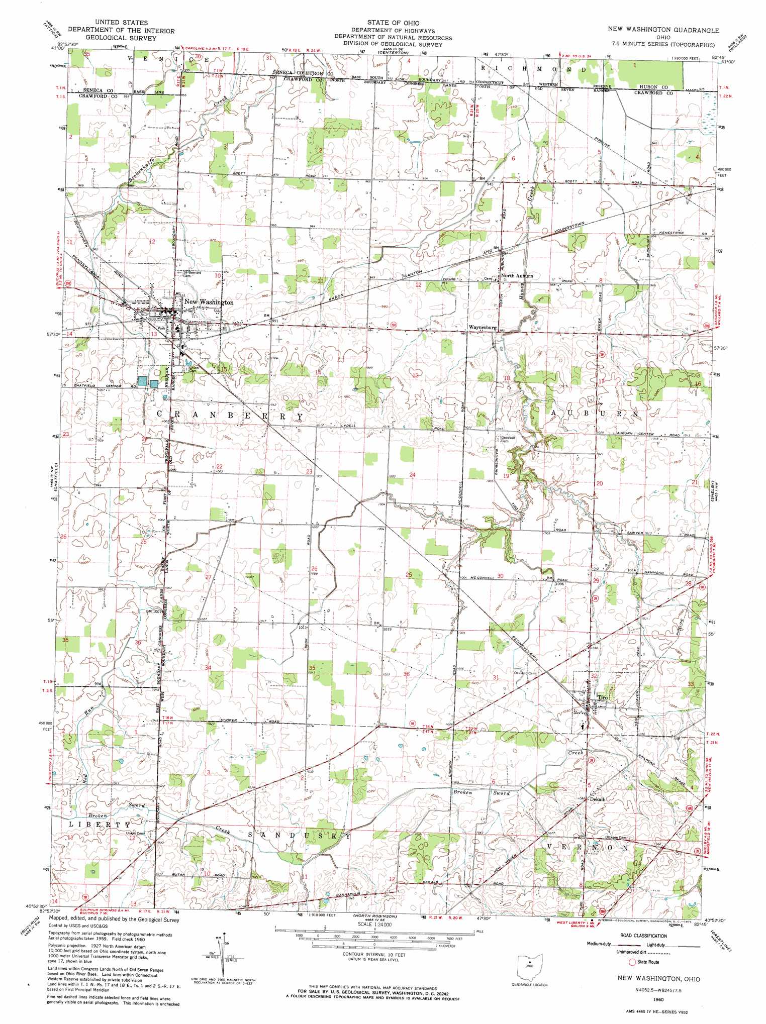
USGS Topo Quad 40082h7 - 1:24,000 scale
| Topo Map Name: | New Washington |
| USGS Topo Quad ID: | 40082h7 |
| Print Size: | ca. 21 1/4" wide x 27" high |
| Southeast Coordinates: | 40.875° N latitude / 82.75° W longitude |
| Map Center Coordinates: | 40.9375° N latitude / 82.8125° W longitude |
| U.S. State: | OH |
| Filename: | o40082h7.jpg |
| Download Map JPG Image: | New Washington topo map 1:24,000 scale |
| Map Type: | Topographic |
| Topo Series: | 7.5´ |
| Map Scale: | 1:24,000 |
| Source of Map Images: | United States Geological Survey (USGS) |
| Alternate Map Versions: |
New Washington OH 1960, updated 1961 Download PDF Buy paper map New Washington OH 1960, updated 1973 Download PDF Buy paper map New Washington OH 2010 Download PDF Buy paper map New Washington OH 2013 Download PDF Buy paper map New Washington OH 2016 Download PDF Buy paper map |
1:24,000 Topo Quads surrounding New Washington
Watson |
Fireside |
Flat Rock |
Monroeville |
Norwalk |
Bloomville |
Attica |
Centerton |
Willard |
Greenwich |
Lykens |
Chatfield |
New Washington |
Shelby |
Shiloh |
Oceola |
Bucyrus |
North Robinson |
Crestline |
Mansfield North |
Monnett |
Caledonia |
Galion |
Blooming Grove |
Mansfield South |
> Back to 40082e1 at 1:100,000 scale
> Back to 40082a1 at 1:250,000 scale
> Back to U.S. Topo Maps home
New Washington topo map: Gazetteer
New Washington: Dams
New Washington Upground Reservoir Dam elevation 305m 1000′New Washington: Populated Places
Dekalb elevation 329m 1079′Mechanicsburg elevation 314m 1030′
New Washington elevation 302m 990′
North Auburn elevation 296m 971′
Tiro elevation 321m 1053′
Waynesburg elevation 299m 980′
New Washington: Post Offices
De Kalb Post Office (historical) elevation 331m 1085′New Washington Post Office elevation 302m 990′
North Auburn Post Office (historical) elevation 295m 967′
Tiro Post Office elevation 321m 1053′
New Washington: Reservoirs
New Washington Upground Reservoir elevation 305m 1000′New Washington: Streams
Red Run elevation 300m 984′New Washington digital topo map on disk
Buy this New Washington topo map showing relief, roads, GPS coordinates and other geographical features, as a high-resolution digital map file on DVD:
 map DVD")