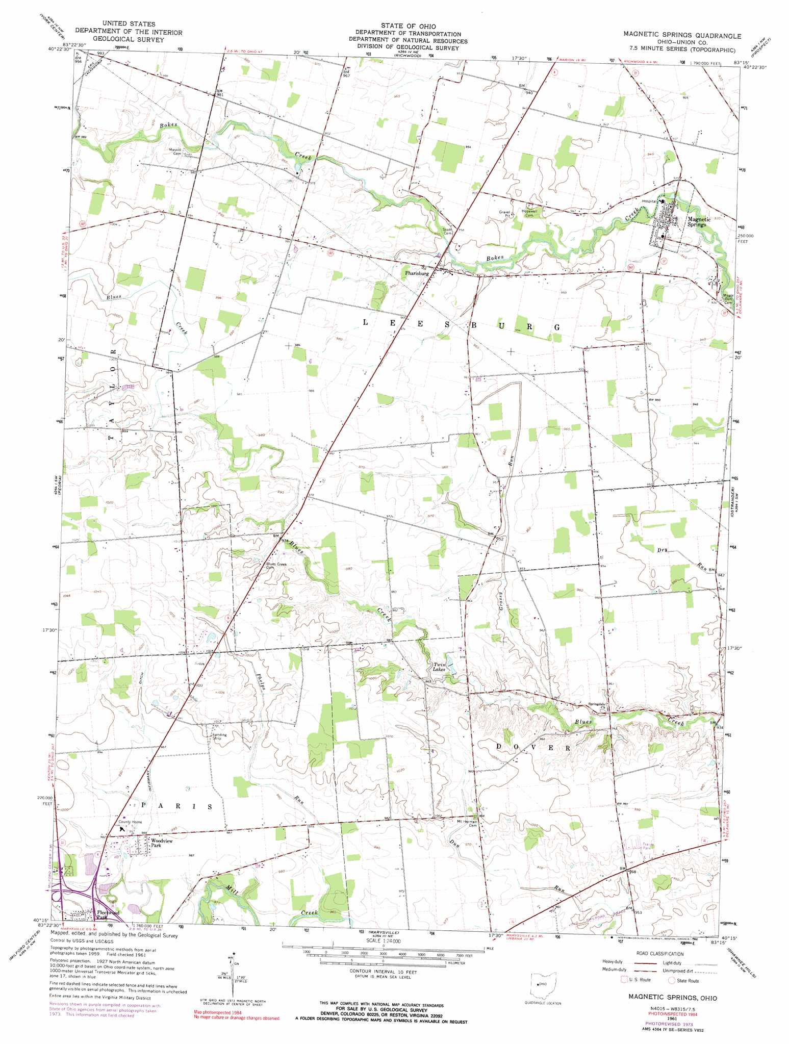
Magnetic Springs Topo Map Ohio
To zoom in, hover over the map of Magnetic Springs
USGS Topo Quad 40083c3 - 1:24,000 scale
| Topo Map Name: | Magnetic Springs |
| USGS Topo Quad ID: | 40083c3 |
| Print Size: | ca. 21 1/4" wide x 27" high |
| Southeast Coordinates: | 40.25° N latitude / 83.25° W longitude |
| Map Center Coordinates: | 40.3125° N latitude / 83.3125° W longitude |
| U.S. State: | OH |
| Filename: | o40083c3.jpg |
| Download Map JPG Image: | Magnetic Springs topo map 1:24,000 scale |
| Map Type: | Topographic |
| Topo Series: | 7.5´ |
| Map Scale: | 1:24,000 |
| Source of Map Images: | United States Geological Survey (USGS) |
| Alternate Map Versions: |
Magnetic Springs OH 1961, updated 1962 Download PDF Buy paper map Magnetic Springs OH 1961, updated 1974 Download PDF Buy paper map Magnetic Springs OH 1961, updated 1990 Download PDF Buy paper map Magnetic Springs OH 2010 Download PDF Buy paper map Magnetic Springs OH 2013 Download PDF Buy paper map Magnetic Springs OH 2016 Download PDF Buy paper map |
1:24,000 Topo Quads surrounding Magnetic Springs
Mount Victory |
La Rue |
New Bloomington |
Marion West |
Marion East |
West Mansfield |
York Center |
Richwood |
Prospect |
Waldo |
East Liberty |
Peoria |
Magnetic Springs |
Ostrander |
Delaware |
North Lewisburg |
Milford Center |
Marysville |
Shawnee Hills |
Powell |
Mechanicsburg |
Plumwood |
Plain City |
Hilliard |
Northwest Columbus |
> Back to 40083a1 at 1:100,000 scale
> Back to 40082a1 at 1:250,000 scale
> Back to U.S. Topo Maps home
Magnetic Springs topo map: Gazetteer
Magnetic Springs: Airports
Bayes Airport elevation 290m 951′Magnetic Springs: Canals
Infirmary Ditch elevation 300m 984′Magnetic Springs: Parks
Union County Sports Complex elevation 301m 987′Magnetic Springs: Populated Places
Fleetwood Park elevation 298m 977′Magnetic Springs elevation 284m 931′
Pharisburg elevation 290m 951′
Woodview Park elevation 299m 980′
Magnetic Springs: Post Offices
Magnetic Springs Post Office elevation 285m 935′Pharisburg Post Office (historical) elevation 290m 951′
Magnetic Springs: Reservoirs
Twin Lakes elevation 292m 958′Magnetic Springs: Streams
Grassy Run elevation 291m 954′Phelps Run elevation 296m 971′
Magnetic Springs digital topo map on disk
Buy this Magnetic Springs topo map showing relief, roads, GPS coordinates and other geographical features, as a high-resolution digital map file on DVD:
 map DVD")