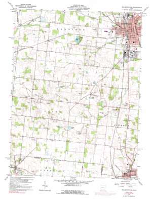
Bellefontaine Topo Map Ohio
To zoom in, hover over the map of Bellefontaine
USGS Topo Quad 40083c7 - 1:24,000 scale
| Topo Map Name: | Bellefontaine |
| USGS Topo Quad ID: | 40083c7 |
| Print Size: | ca. 21 1/4" wide x 27" high |
| Southeast Coordinates: | 40.25° N latitude / 83.75° W longitude |
| Map Center Coordinates: | 40.3125° N latitude / 83.8125° W longitude |
| U.S. State: | OH |
| Filename: | o40083c7.jpg |
| Download Map JPG Image: | Bellefontaine topo map 1:24,000 scale |
| Map Type: | Topographic |
| Topo Series: | 7.5´ |
| Map Scale: | 1:24,000 |
| Source of Map Images: | United States Geological Survey (USGS) |
| Alternate Map Versions: |
Bellefontaine OH 1960, updated 1962 Download PDF Buy paper map Bellefontaine OH 1960, updated 1973 Download PDF Buy paper map Bellefontaine OH 1960, updated 1992 Download PDF Buy paper map Bellefontaine OH 2010 Download PDF Buy paper map Bellefontaine OH 2013 Download PDF Buy paper map Bellefontaine OH 2016 Download PDF Buy paper map |
1:24,000 Topo Quads surrounding Bellefontaine
> Back to 40083a1 at 1:100,000 scale
> Back to 40082a1 at 1:250,000 scale
> Back to U.S. Topo Maps home
Bellefontaine topo map: Gazetteer
Bellefontaine: Airports
Tangers Airport elevation 359m 1177′Bellefontaine: Lakes
Kenan Pond elevation 341m 1118′Lemen Lake elevation 330m 1082′
McMillen Lake elevation 325m 1066′
Ruby Lake elevation 338m 1108′
Silver Lake elevation 333m 1092′
Bellefontaine: Parks
Blair Casey Park elevation 398m 1305′Blue Jacket Park elevation 379m 1243′
Brown Park elevation 384m 1259′
Harmon Field Park elevation 364m 1194′
Iron City Park elevation 371m 1217′
Lewis Ratcliff Park elevation 363m 1190′
McCracken-Myrtle Park elevation 377m 1236′
Powell Park elevation 379m 1243′
Rutan Park elevation 393m 1289′
Bellefontaine: Populated Places
Bellefontaine elevation 379m 1243′Gretna elevation 330m 1082′
Iron City elevation 378m 1240′
Springhills elevation 322m 1056′
West Liberty elevation 332m 1089′
Bellefontaine: Post Offices
Bellefontaine Post Office elevation 376m 1233′Gretna Post Office (historical) elevation 329m 1079′
Springhill Post Office (historical) elevation 323m 1059′
West Liberty Post Office elevation 332m 1089′
Bellefontaine: Reservoirs
Braden Lake elevation 328m 1076′Doke Lake elevation 339m 1112′
Newell Lake elevation 328m 1076′
Twin Lakes elevation 345m 1131′
Bellefontaine: Streams
Blue Jacket Creek elevation 319m 1046′McKees Creek elevation 305m 1000′
Bellefontaine: Summits
Jewel Hill elevation 373m 1223′Bellefontaine digital topo map on disk
Buy this Bellefontaine topo map showing relief, roads, GPS coordinates and other geographical features, as a high-resolution digital map file on DVD:


