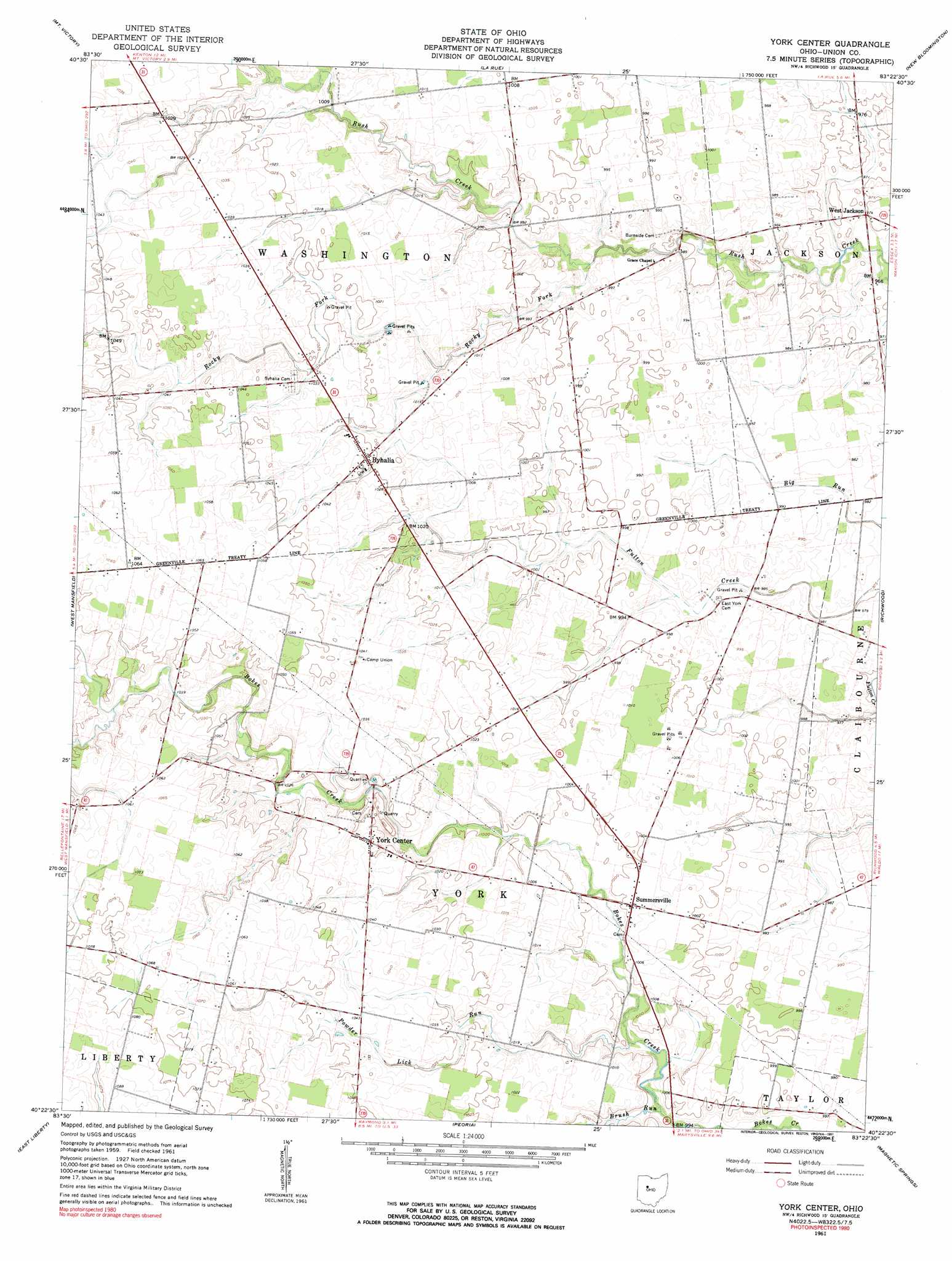
York Center Topo Map Ohio
To zoom in, hover over the map of York Center
USGS Topo Quad 40083d4 - 1:24,000 scale
| Topo Map Name: | York Center |
| USGS Topo Quad ID: | 40083d4 |
| Print Size: | ca. 21 1/4" wide x 27" high |
| Southeast Coordinates: | 40.375° N latitude / 83.375° W longitude |
| Map Center Coordinates: | 40.4375° N latitude / 83.4375° W longitude |
| U.S. State: | OH |
| Filename: | o40083d4.jpg |
| Download Map JPG Image: | York Center topo map 1:24,000 scale |
| Map Type: | Topographic |
| Topo Series: | 7.5´ |
| Map Scale: | 1:24,000 |
| Source of Map Images: | United States Geological Survey (USGS) |
| Alternate Map Versions: |
York Center OH 1961, updated 1963 Download PDF Buy paper map York Center OH 1961, updated 1991 Download PDF Buy paper map York Center OH 2010 Download PDF Buy paper map York Center OH 2013 Download PDF Buy paper map York Center OH 2016 Download PDF Buy paper map |
1:24,000 Topo Quads surrounding York Center
Foraker |
Kenton |
Marseilles |
Meeker |
Morral |
Silver Creek |
Mount Victory |
La Rue |
New Bloomington |
Marion West |
Rushsylvania |
West Mansfield |
York Center |
Richwood |
Prospect |
Zanesfield |
East Liberty |
Peoria |
Magnetic Springs |
Ostrander |
Kingscreek |
North Lewisburg |
Milford Center |
Marysville |
Shawnee Hills |
> Back to 40083a1 at 1:100,000 scale
> Back to 40082a1 at 1:250,000 scale
> Back to U.S. Topo Maps home
York Center topo map: Gazetteer
York Center: Populated Places
Arbela elevation 301m 987′Byhalia elevation 314m 1030′
Haynesville (historical) elevation 302m 990′
Summersville elevation 306m 1003′
West Jackson elevation 297m 974′
York Center elevation 315m 1033′
York Center: Post Offices
Arbela Post Office elevation 301m 987′Byhalia Post Office (historical) elevation 314m 1030′
York Center: Streams
Brush Run elevation 300m 984′Middle Branch Bokes Creek elevation 314m 1030′
Powder Lick Run elevation 300m 984′
Rocky Fork elevation 299m 980′
York Center digital topo map on disk
Buy this York Center topo map showing relief, roads, GPS coordinates and other geographical features, as a high-resolution digital map file on DVD:
 map DVD")