Arlington Topo Map Ohio
To zoom in, hover over the map of Arlington
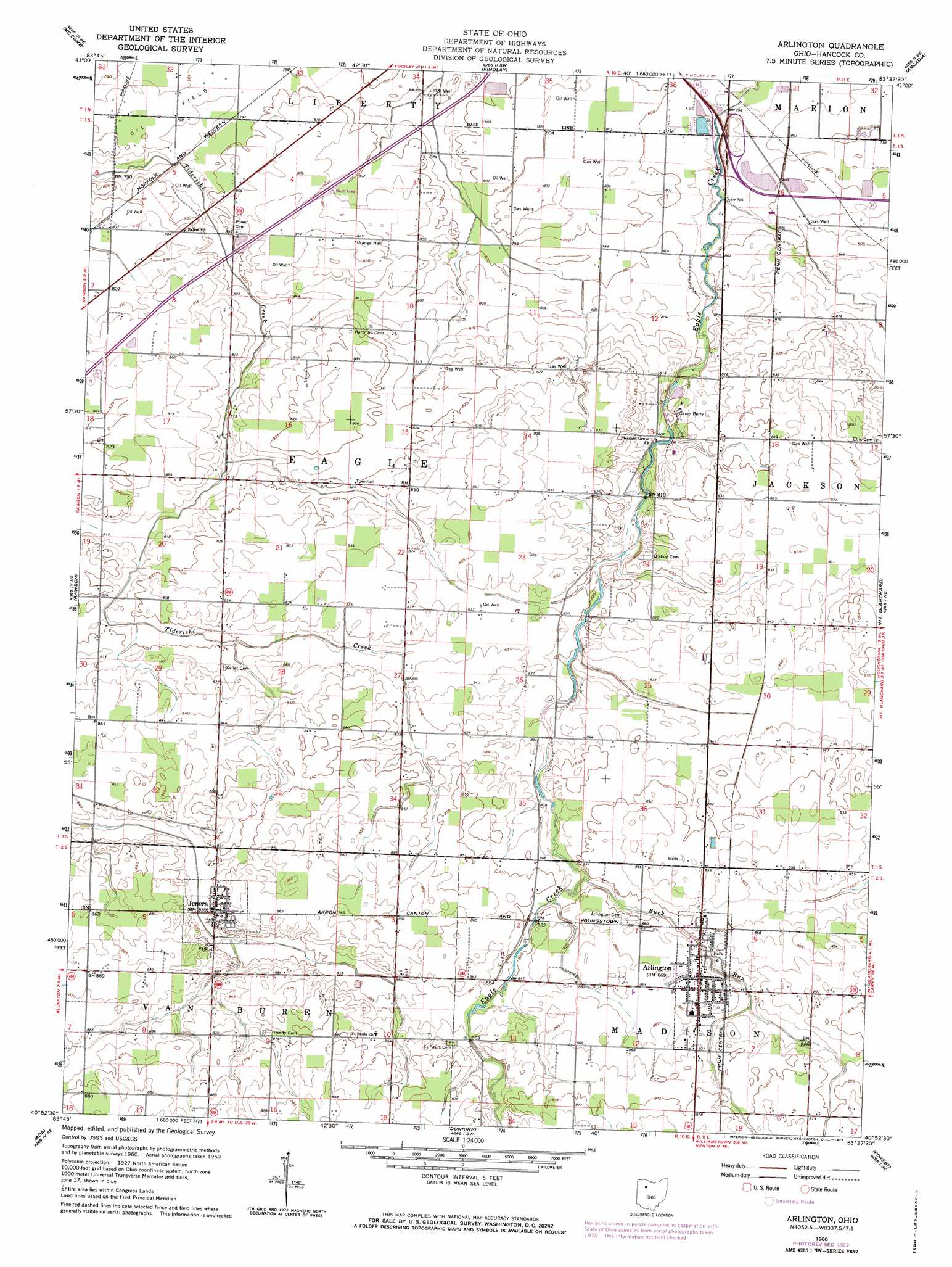
USGS Topo Quad 40083h6 - 1:24,000 scale
| Topo Map Name: | Arlington |
| USGS Topo Quad ID: | 40083h6 |
| Print Size: | ca. 21 1/4" wide x 27" high |
| Southeast Coordinates: | 40.875° N latitude / 83.625° W longitude |
| Map Center Coordinates: | 40.9375° N latitude / 83.6875° W longitude |
| U.S. State: | OH |
| Filename: | o40083h6.jpg |
| Download Map JPG Image: | Arlington topo map 1:24,000 scale |
| Map Type: | Topographic |
| Topo Series: | 7.5´ |
| Map Scale: | 1:24,000 |
| Source of Map Images: | United States Geological Survey (USGS) |
| Alternate Map Versions: |
Arlington OH 1960, updated 1961 Download PDF Buy paper map Arlington OH 1960, updated 1973 Download PDF Buy paper map Arlington OH 1960, updated 1973 Download PDF Buy paper map Arlington OH 2010 Download PDF Buy paper map Arlington OH 2013 Download PDF Buy paper map Arlington OH 2016 Download PDF Buy paper map |
1:24,000 Topo Quads surrounding Arlington
Deshler |
Hoytville |
North Baltimore |
Bloomdale |
Fostoria |
Leipsic |
Mccomb |
Findlay |
Arcadia |
Alvada |
Bluffton |
Rawson |
Arlington |
Mount Blanchard |
Carey |
Beaverdam |
Ada |
Dunkirk |
Forest |
Wharton |
Harrod |
Alger |
Foraker |
Kenton |
Marseilles |
> Back to 40083e1 at 1:100,000 scale
> Back to 40082a1 at 1:250,000 scale
> Back to U.S. Topo Maps home
Arlington topo map: Gazetteer
Arlington: Airports
Alge Airport elevation 261m 856′Ferrell Airport elevation 248m 813′
Arlington: Populated Places
Arlington elevation 263m 862′Beagle (historical) elevation 256m 839′
Jenera elevation 260m 853′
Martinstown (historical) elevation 260m 853′
Arlington: Post Offices
Arlington Post Office (historical) elevation 264m 866′Beagle Post Office (historical) elevation 256m 839′
Jenera Post Office elevation 260m 853′
Arlington: Streams
Buck Run elevation 259m 849′Arlington digital topo map on disk
Buy this Arlington topo map showing relief, roads, GPS coordinates and other geographical features, as a high-resolution digital map file on DVD:
 map DVD")