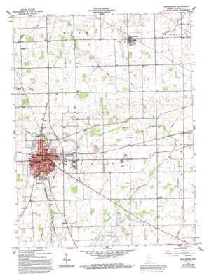
Winchester Topo Map Indiana
To zoom in, hover over the map of Winchester
USGS Topo Quad 40084b8 - 1:24,000 scale
| Topo Map Name: | Winchester |
| USGS Topo Quad ID: | 40084b8 |
| Print Size: | ca. 21 1/4" wide x 27" high |
| Southeast Coordinates: | 40.125° N latitude / 84.875° W longitude |
| Map Center Coordinates: | 40.1875° N latitude / 84.9375° W longitude |
| U.S. State: | IN |
| Filename: | o40084b8.jpg |
| Download Map JPG Image: | Winchester topo map 1:24,000 scale |
| Map Type: | Topographic |
| Topo Series: | 7.5´ |
| Map Scale: | 1:24,000 |
| Source of Map Images: | United States Geological Survey (USGS) |
| Alternate Map Versions: |
Winchester IN 1960, updated 1961 Download PDF Buy paper map Winchester IN 1960, updated 1988 Download PDF Buy paper map Winchester IN 1960, updated 1995 Download PDF Buy paper map Winchester IN 2010 Download PDF Buy paper map Winchester IN 2013 Download PDF Buy paper map Winchester IN 2016 Download PDF Buy paper map |
1:24,000 Topo Quads surrounding Winchester
> Back to 40084a1 at 1:100,000 scale
> Back to 40084a1 at 1:250,000 scale
> Back to U.S. Topo Maps home
Winchester topo map: Gazetteer
Winchester: Airports
Randolph County Airport elevation 341m 1118′Saratoga Airport elevation 320m 1049′
Winchester: Canals
Shelley Ditch elevation 336m 1102′Winchester: Parks
Goodrich Park elevation 329m 1079′Winchester: Populated Places
Harrisville elevation 336m 1102′Saratoga elevation 320m 1049′
Winchester elevation 333m 1092′
Winchester: Streams
Hickory Creek elevation 310m 1017′Owl Creek elevation 336m 1102′
Peach Creek elevation 327m 1072′
Salt Creek elevation 325m 1066′
Sugar Creek elevation 322m 1056′
Winchester digital topo map on disk
Buy this Winchester topo map showing relief, roads, GPS coordinates and other geographical features, as a high-resolution digital map file on DVD:
Northern Illinois, Northern Indiana & Southwestern Michigan
Buy digital topo maps: Northern Illinois, Northern Indiana & Southwestern Michigan


