North Star Topo Map Ohio
To zoom in, hover over the map of North Star
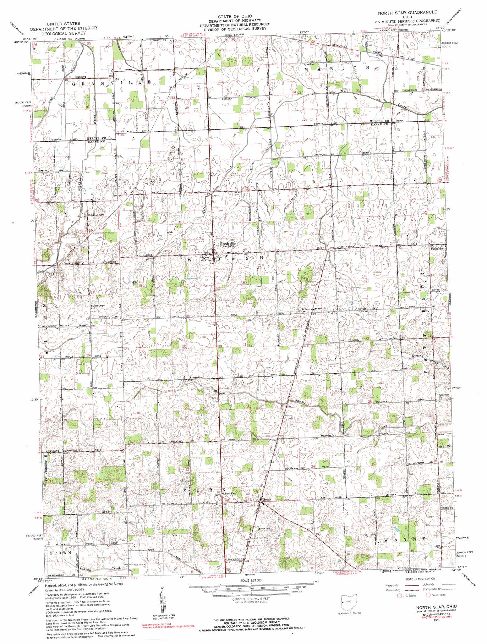
USGS Topo Quad 40084c5 - 1:24,000 scale
| Topo Map Name: | North Star |
| USGS Topo Quad ID: | 40084c5 |
| Print Size: | ca. 21 1/4" wide x 27" high |
| Southeast Coordinates: | 40.25° N latitude / 84.5° W longitude |
| Map Center Coordinates: | 40.3125° N latitude / 84.5625° W longitude |
| U.S. State: | OH |
| Filename: | o40084c5.jpg |
| Download Map JPG Image: | North Star topo map 1:24,000 scale |
| Map Type: | Topographic |
| Topo Series: | 7.5´ |
| Map Scale: | 1:24,000 |
| Source of Map Images: | United States Geological Survey (USGS) |
| Alternate Map Versions: |
North Star OH 1961, updated 1963 Download PDF Buy paper map North Star OH 1961, updated 1990 Download PDF Buy paper map North Star OH 2010 Download PDF Buy paper map North Star OH 2013 Download PDF Buy paper map North Star OH 2016 Download PDF Buy paper map |
1:24,000 Topo Quads surrounding North Star
New Corydon |
Erastus |
Celina |
Saint Marys |
Moulton |
Fort Recovery |
Coldwater |
Montezuma |
New Bremen |
New Knoxville |
Cosmos |
Rossburg |
North Star |
Osgood |
Fort Loramie |
Union City |
Ansonia |
Dawn |
Versailles |
Piqua West |
Spartanburg |
Greenville West |
Greenville East |
Gettysburg |
Pleasant Hill |
> Back to 40084a1 at 1:100,000 scale
> Back to 40084a1 at 1:250,000 scale
> Back to U.S. Topo Maps home
North Star topo map: Gazetteer
North Star: Canals
Honsapple Ditch elevation 295m 967′Ward Ditch elevation 291m 954′
North Star: Populated Places
Brock elevation 318m 1043′Delvin (historical) elevation 302m 990′
North Star elevation 306m 1003′
North Star: Post Offices
Brock Post Office (historical) elevation 318m 1043′Delvin Post Office (historical) elevation 302m 990′
North Star Post Office elevation 305m 1000′
North Star digital topo map on disk
Buy this North Star topo map showing relief, roads, GPS coordinates and other geographical features, as a high-resolution digital map file on DVD:
Northern Illinois, Northern Indiana & Southwestern Michigan
Buy digital topo maps: Northern Illinois, Northern Indiana & Southwestern Michigan